Disclosure : This site contains affiliate links to products. We may receive a commission for purchases made through these links.
Dundee East 1901

Dundee East in 1901 in a fascinating series of reproductions of old Ordnance Survey plans in the Alan Godfrey Editions, ideal for anyone interested in the history of their neighbourhood or family. The map covers the eastern half of Dundee, stretching from Brown Constable Street eastward to the Eastern Necropolis, and from Sandeman Street southward to Victoria Dock. Features include Victoria Dock, Camperdown Dock, Caledon Shipbuilding Yard, railway approaches from east, Camperdown Shipbuilding Yard, Dundee Fish Depot, Eastern Necropolis, St Patrick`s RC church, Manhattan Works, Poorhouse, Stobswell Works, Baxter Park, Fourth Ward area, First Ward area, Cattle Market, Taybank Works, East End Mineral Depot, Morgan Academy, Parochial Hospital, Greendykes, Craigie Bank, bathing ponds, tramways, etc. On the reverse are street directory entries for Albert Street, Arbroath Road, Baffin Street, Baxter Park Terrace, Dock Street and Park Avenue. About the Alan Godfrey Editions of the 25″ OS Series:Selected towns in Great Britain and Ireland are covered by maps showing the extent of urban development in the last decades of the 19th and early 20th century. The plans have been taken from the Ordnance Survey mapping and reprinted at about 15 inches to one mile (1:4,340). On the reverse most maps have historical notes and many also include extracts from contemporary directories. Most maps cover about one mile (1.6kms) north/south, one and a half miles (2.4kms) across; adjoining sheets can be combined to provide wider coverage.FOR MORE INFORMATION AND A COMPLETE LIST OF ALL AVAILABLE TITLES PLEASE CLICK ON THE SERIES LINK.

Related Products:
 Dundee West 1901
 Hull (East) 1908 – 240.03b
 Hull (East) 1928 – 240.03c
Hull (East) 1890 – 240.03a Colour Edition
Bangor East 1901
Smethwick 1901 – 72.03a
Hull (East) 1928 – 240.03c
Hull (East) 1890 – 240.03a Colour Edition
Bangor East 1901
Smethwick 1901 – 72.03a
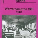 Wolverhampton (SE) 1901 – 62.11b
Glasgow East End 1893
Wolverhampton (SE) 1901 – 62.11b
Glasgow East End 1893
 Sedgley South-East with Swan Village and West Coseley 1901
 Walsall (SE) 1901 – 63.11
Belfast (East) 1902 – 4.11
Walsall (SE) 1901 – 63.11
Belfast (East) 1902 – 4.11
 Walsall (SW) & Pleck 1901 – 63.10a
Carlisle North-East 1924
Motherwell (East) 1897 – 12.14
East Jarrow 1913
Craigendoran and Helensburgh East 1897
Gateshead East 1895
Walsall (SW) & Pleck 1901 – 63.10a
Carlisle North-East 1924
Motherwell (East) 1897 – 12.14
East Jarrow 1913
Craigendoran and Helensburgh East 1897
Gateshead East 1895
 Hull North East 1908
Darlaston & King`s Hill 1901
Leeds Central and North East 1890
Hull North East 1908
Darlaston & King`s Hill 1901
Leeds Central and North East 1890
 Northwich North East 1908
 Canning Town & Custom House 1894 – 66.2
 Canning Town & Custom House 1914 – 66.3
East Ham & Barking 1915 – 44.3
Kilnhurst 1901
Southampton (East) 1908 – 65.11a
Swinton 1901
Canning Town & Custom House 1914 – 66.3
East Ham & Barking 1915 – 44.3
Kilnhurst 1901
Southampton (East) 1908 – 65.11a
Swinton 1901
 Stockport East 1897
 Dudley Castle 1901
Mexborough 1901
Dudley Castle 1901
Mexborough 1901
 Croydon East: Coombe Park & Addiscombe Road 1895 – 158
 Hartlepool 1914 – 37.07c
Carlisle South-East 1924
Hartlepool 1914 – 37.07c
Carlisle South-East 1924
 Liverpool North 1906
Dumbarton 1897
Weymouth 1901
Liverpool North 1906
Dumbarton 1897
Weymouth 1901
 Birkenhead 1909 – 13.03b
Barnsley South East 1904
Birkenhead 1909 – 13.03b
Barnsley South East 1904
 Bradford East 1906
Wyke Regis 1901
Bradford East 1906
Wyke Regis 1901