Disclosure : This site contains affiliate links to products. We may receive a commission for purchases made through these links.
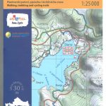
Dublin Mountains (25K)

Dublin Mountains at 1:25,000 on a double-sided, detailed, GPS compatible map from EastWest Mapping, printed on light, waterproof and tear-resistant paper. Contours at 10m intervals are enhanced by altitude colouring and graphics showing scree, peat bogs, marshland, gorse, different types of woodlands, cultivated areas, etc.The map shows the Wicklow Way, the Dublin Mountain Way and other agreed access routes. Hillwalking access points are also marked. A wide range of symbols indicate various places of interest including hotels and campsites, pubs, shops, restaurants, rock climbing and bird watching sites, recreational facilities, historical and geological sites, etc. The map has a 1km UTM grid and provides additional information about recreational pursuits in this area. Current edition of this title was published in late 2010.To see the other titles in this series please click on the series link.

Related Products:
 Dublin and North Wicklow Mountains (30K)
 Ireland: EastWest Mapping Hiking Maps of the Wicklow Mountains
 Wicklow Mountains East
 Lugnaquilla & Glendalough
 Berlitz Pocket Guide Dublin
 Admiralty Chart SC5621_12 – Dublin Bay Southern Part – Port of Dublin
 Dublin Red Maps
 Dublin PopOut
 DK Eyewitness Pocket Map and Guide: Dublin
 Dublin Strolls: Exploring Dublin`s Architectural Treasures: 2016
 Dublin – Meath – Kildare – Wicklow OSI Discovery 50
 The 500 Hidden Secrets of Dublin
 France: Kummerly + Frey Recreational Maps of the Vosges Mountains and Alsace
 Dublin City Centre Tourist Map
 DK Eyewitness Top 10 Dublin
 Rick Steves Snapshot Dublin – Sixth Edition
 Dublin F&B City Pocket Map
 Picos de Europa National Park 3-Map and Guide Set CNIG ENGLISH
 Totnes Walking Map 28
 Picos de Europa National Park 3-Map and Guide Set CNIG SPANISH
 Sierra de Guadarrama National Park 4-Map and Guide Set CNIG
 La Tablas de Daimiel National Park CNIG Map-Guide SPANISH
 Totnes & Dartmouth Cycle Map 62
 Budleigh Salterton & Otterton Walking Map 40
 The Hunt Dublin
 Dartmouth – Dittisham & Coast to Brixham Walking Map 26
 prettycitydublin: Discovering Dublin`s Beautiful Places
 Dublin in 50 Buildings
 Dublin Collins Streetfinder Colour Map
 Dublin & Wicklow: A Walking Guide
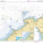
 Admiralty Chart SC5621_1 – Dublin to Anglesey
 Dublin Marco Polo Pocket Travel Guide 2019 – with pull out map
 Admiralty Chart SC5621_5 – Dublin to Drogheda Approaches
 Dublin Lonely Planet City Map
 Braunton & Ilfracombe Cycle Map 60 – with Tarka Trail & Barnstaple
 Admiralty Chart 1447 – Dublin and Dun Laoghaire
 Dublin 3D Expanding City Skyline – Pocket Pop up Book
 Fodor`s Dublin 25 Best
 Siniscola
 Admiralty Chart 1415 – Dublin Bay