Disclosure : This site contains affiliate links to products. We may receive a commission for purchases made through these links.
Dresden Freytag & Berndt Map
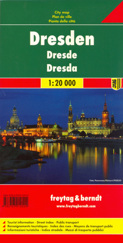
Indexed street map of Dresden at 1:20,000 from Freytag & Berndt with an enlargement of the Old Town at 1:8,000, as well as map of the environs of Dresden. Mapping is bright, colourful and clear, with one-way streets shown, as well as the S-bahn, bus, tram, cable-car and Elbe ferry networks with stops clearly indicated.Points of interest such as museums of the Dresden State Art Collections, the the Saxon State Opera, theatres and parks are marked, as are local facilities. The enlargement of the Old Town shares the same mapping but with more clarity, and is indexed along with the main map on the reverse. A map of the city’s environs shows the major road network leading into Dresden.A diagram of Dresden`s VGN Network (S-bahn, bus, tram, cable-car and Elbe ferry) included. Map legend includes English.

Related Products:
 Cologne Freytag & Berndt Map
 Dresden City Pocket Plan
 Hamburg F&B
 Frankfurt am Main F&B
 Dresden Falk Cityplan
 Hanover F&B
 Hamburg Borch
 Riga ITMB
 Frankfurt am Main Borch
 Dresden Falk Special Fold Plan
 Munich & Bavaria ITMB
 Dresden and Environs
 Freytag & Berndt City Pocket Street Plans
Italy: Freytag & Berndt “Top 10 Tips” Road Maps
Freytag & Berndt City Pocket Street Plans
Italy: Freytag & Berndt “Top 10 Tips” Road Maps
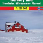 Norway: Freytag & Berndt Regional Road Maps
 Dresden EXTRA
 Berlin Borch
 Munich F&B
 Munich F&B Wall Map
 Zurich VBZ City Map
 Munich F&B Wall Map – with Metal Hanging Strips
 Helsinki City Map & Guide
 Sweden: Freytag & Berndt Regional Road Maps
 Istanbul & Northwest Turkey ITMB
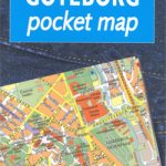 Gothenburg Pocket Atlas
 Barcelona Borch
 Milan Freytag & Berndt Map
 Dresden: The Fire and the Darkness
 Europe – Middle East – Central Asia Freytag & Berndt Wall Map
 Dresden, 3 Days in
 Attersee – Mondsee – Wolfgangsee Freytag & Berndt Map
Nuremberg Falk EXTRA Street Plan
Attersee – Mondsee – Wolfgangsee Freytag & Berndt Map
Nuremberg Falk EXTRA Street Plan
 Austria: Freytag & Berndt Cycling Maps
 Munich Borch
 Stockholm Borch
 Grossglockner – Heiligenbult – Sonnblick – Shobergruppe – Oberes Mรถlltal Freytag & Berndt Map
 Berlin Cityplan Pocket Map
 Nuremberg City Pocket Plan
 Vienna Borch