Disclosure : This site contains affiliate links to products. We may receive a commission for purchases made through these links.
Doubs – Jura IGN D721319


Related Products:
 Doubs – Jura Michelin Local 321
 Clos du Doubs Swisstopo 222
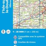 l`Isle-sur-le-Doubs – Villersexel IGN 3522SB
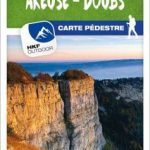 Val de Travers – Areuse – Doubs K+F Hiking Map 16
 Morteau – Saut du Doubs IGN 3524OT
 Montbeliard – Vallee du Doubs IGN 3622OT
 Maiche – Gorges du Doubs IGN 3623OT
 Clos du Doubs Swisstopo Hiking 222T
 Baume-les-Dames – Vallee du Doubs IGN 3423ET
 La Grande Traversee du Jura GR5/GR9/GTJ
 Jura ร pied 46PR
 Jura & Colonsay OS Landranger Map 61 (paper)
 Jura & Colonsay OS Landranger Map 61 (waterproof)
Le PNR du Haute-Jura ร pied PN15
Jura & Colonsay OS Landranger Map 61 (waterproof)
Le PNR du Haute-Jura ร pied PN15
 Islay, Jura & Colonsay Nicolson Tourist Map
 High Jura – Northern Alps IGN Top200 202
 Oyonnax – Gorges de l`Ain – PNR du Haut Jura IGN 3228OT
 The GR5 Trail – Vosges and Jura: Schirmeck to Lac Leman, and the GR53
 Islay, Jura and Colonsay: 40 Coast and Country Walks
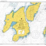 Admiralty Chart 2168 – Approaches to the Sound of Jura
 Isles of Islay, Jura and Colonsay – 8 Easy to Follow Walks
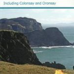 Discover the Isles of Islay & Jura – Including Colonsy and Oronsay
 Admiralty Chart 2397 – Sound of Jura – Northern Part
 Admiralty Chart 2396 – Sound of Jura – Southern Part
 Switzerland`s Jura Crest Trail: A two week trek from Zurich to Geneva
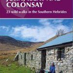 Walking on Jura, Islay and Colonsay: 23 wild walks in the Southern Hebrides
 Les Sentiers des Patrimoines dans le Jura FFRP Topo-guide No. SP03
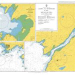 Admiralty Chart 2476 – Lochs and Harbours in the Sound of Jura and Approaches
 Haut-Jura IGN 75012
 Jura – Franches-Montagnes
 Krakรณw ‘“ Czestochowa Jura
 Jura – Ajoie K+F Hiking Map 04
 Jura & Scarba OS Explorer Map 355 (paper)
 Jura Harvey Superwalker XT25
 Grandes Traversees du Jura IGN 89026
 Nuremberg Land – Franconian Jura
 Jura – Biel-Bienne Supertrail Map
 Basel – Solothurner Jura K+F Hiking Map 05
 Jura – Franches-Montagnes – Ajoie K+F Hiking 3
 Burgundy – Jura Michelin Green Guide