Disclosure : This site contains affiliate links to products. We may receive a commission for purchases made through these links.
Dorchester – Puddletown & District 1903 – 328

Related Products:
 Harlech & District 1903 – 135
 Nefyn & District 1903 – 118
 Brampton & District 1903 – 18
 Bangor – Bethesda & District 1903 – 106
 Keswick & the Northern Lake District 1903 – 29
 Dorchester 1901
 Weymouth – Dorchester A-Z Street Atlas
 Dorchester 1886 – 40.15a Colour Edition
 CHS Chart 7066 – Cape Dorchester to Spicer Islands
 Dorchester, Weymouth, Cerne Abbas & Bere Regis OS Landranger Map 194 (paper)
 Dorchester, Weymouth, Cerne Abbas & Bere Regis OS Landranger Active Map 194 (waterproof)
 Purbeck & South Dorset – Poole, Dorchester – Weymouth & Swanage OS Explorer Map OL15 (paper)
 Preili District – Aglona – Livani – Riebini – Varkava District Jana Seta Map
 Madona District – Cesvaine – Ergli – Lubana – Varaklani District Jana Seta Map
 Tukums District – Engure – Jaunpils – Kandava District Jana Seta Map
 Bauska District – Iecava – Rundale – Vecumnieki District Jana Seta Map
 Limbazi District – Aloja – Krimulda – Salacgriva District Jana Seta Map
 Purbeck & South Dorset – Poole, Dorchester – Weymouth & Swanage OS Explorer Active Map OL15 (waterproof)
 Kraslava District – Aglona – Dagda District Jana Seta Map
 Daugavpils District – Ilukste District Jana Seta Map
 Dore 1903 – 298.06
 Snowdonia 1903 – 119
 Newry 1903 – 46.16
 South Merioneth 1903 – 149
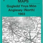 Anglesey (North) 1903 – 92
 Anglesey (S) & Caernarfon 1903 – 105
 Beaumaris & Llandudno 1903 – 94
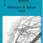 Maryport & Silloth 1903 – 16
 Aberdaron, Pwllheli and Pen Llyn 1903 – 133/134
 Whitehaven & Workington 1903-1914 – 28
Penrith – Inglewood & Hartside 1903 – 24
Whitehaven & Workington 1903-1914 – 28
Penrith – Inglewood & Hartside 1903 – 24
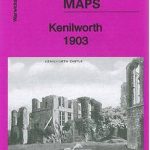 Kenilworth 1903: Warwickshire Sheet 26.10
 Moseley 1903: Warwickshire Sheet 14.13a
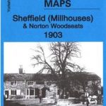 Sheffield (Millhouses) & Norton Woodseats 1903 – 298.03
 Alston Moor & Upper Weardale 1903 – 25
 Lower Weardale & West Durham 1903 – 26
 Caldbeck – Wigton & Northern Fells 1903 – 23
 Lake District Ridge Walks & Scrambles: Challenging high-level routes in the Lake District
Saldus district – Broceni District
Axminster 1903 – 72.05
Lake District Ridge Walks & Scrambles: Challenging high-level routes in the Lake District
Saldus district – Broceni District
Axminster 1903 – 72.05