Disclosure : This site contains affiliate links to products. We may receive a commission for purchases made through these links.
Dorchester 1886 – 40.15a Colour Edition
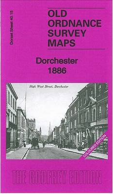
Dorchester in 1886 in a fascinating series of reproductions of old Ordnance Survey plans in the Alan Godfrey Editions, ideal for anyone interested in the history of their neighbourhood or family. Two versions have been published for this area. High West Street and High East Street run down the centre of the map, and coverage stretches westward to Poundbury Camp, eastward to Grey`s Bridge and Fordington Cross, and south to Maumbury Ring. Features include both railway stations, Dorchester Brewery, Fordington, Borough Gardens, Colliton Park, prison (left blank), St George`s church, St Peter`s church, Northernhay, workhouse, Infantry Barracks, Royal Horse Artllery Barracks, Roman defences, River Frome, Coker`s Frome, etc. The 1886 version is in colour, taken from the beautiful 1st Edition OS hand-coloured map and includes on the reverse a list of private residents from an 1895 directory. About the Alan Godfrey Editions of the 25″ OS SeriesSelected towns in Great Britain and Ireland are covered by maps showing the extent of urban development in the last decades of the 19th and early 20th century. The plans have been taken from the Ordnance Survey mapping and reprinted at about 15 inches to one mile (1:4,340). On the reverse most maps have historical notes and many also include extracts from contemporary directories. Most maps cover about one mile (1.6kms) north/south, one and a half miles (2.4kms) across; adjoining sheets can be combined to provide wider coverage.FOR MORE INFORMATION AND A COMPLETE LIST OF ALL AVAILABLE TITLES PLEASE CLICK ON THE SERIES LINK.

Related Products:
 Dorchester 1901
 Taunton 1886 – Colour Edition
Rothesay 1886 – 204.06
South Chilterns 1886
Taunton 1886 – Colour Edition
Rothesay 1886 – 204.06
South Chilterns 1886
 Aldershot 1909
Old Portsmouth & Gosport 1896 – 83.11a
Hull West 1890 (Colour Edition)
Roding Valley and Epping Forest 1886
Exeter 1888 – 80.06a Colour Edition
Leeds South and South East 1890 (Colour Edition)
Aldershot 1909
Old Portsmouth & Gosport 1896 – 83.11a
Hull West 1890 (Colour Edition)
Roding Valley and Epping Forest 1886
Exeter 1888 – 80.06a Colour Edition
Leeds South and South East 1890 (Colour Edition)
 Weymouth – Dorchester A-Z Street Atlas
 Poole 1887 – 43.16a Colour Edition
 Woolwich 1866
Central Liverpool 1890 – 106.14a Colour Edition
Withington and Burnage 1892 (Colour edition)
Woolwich 1866
Central Liverpool 1890 – 106.14a Colour Edition
Withington and Burnage 1892 (Colour edition)
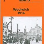 Woolwich 1914
Blackwater and Chelmer 1886
Hornchurch 1915 – 79.15
Woolwich 1914
Blackwater and Chelmer 1886
Hornchurch 1915 – 79.15
 Shrewsbury West 1900
Canterbury 1906 – 46.03
Shrewsbury West 1900
Canterbury 1906 – 46.03
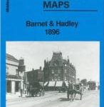 Barnet and Hadley 1896
Brecon 1903 – 28.13
Huddersfield Central 1889 (Colour Edition)
Devonport North 1893
Thame and District 1886
Barnet and Hadley 1896
Brecon 1903 – 28.13
Huddersfield Central 1889 (Colour Edition)
Devonport North 1893
Thame and District 1886
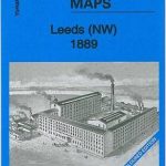 Leeds North West 1889 (Colour Edition)
Paisley 1858 (Colour Edition)
Leeds North West 1889 (Colour Edition)
Paisley 1858 (Colour Edition)
 Walsall (SE) 1901 – 63.11
Bedford 1924 – 11.16b
Central Nottingham 1899 – 42.02b
Hull (East) 1890 – 240.03a Colour Edition
Walsall (SE) 1901 – 63.11
Bedford 1924 – 11.16b
Central Nottingham 1899 – 42.02b
Hull (East) 1890 – 240.03a Colour Edition
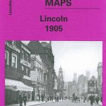 City of Lincoln 1905 – 70.07a
Middlesbrough North 1893 (Colour Edition)
Bridport 1901
Central Newcastle 1894 – 11a
City of Lincoln 1905 – 70.07a
Middlesbrough North 1893 (Colour Edition)
Bridport 1901
Central Newcastle 1894 – 11a
 Ayr 1909 – 33.06
Chester-le-Street 1895 – 13.09a
Swanage 1900
Wrexham Central 1909
Ayr 1909 – 33.06
Chester-le-Street 1895 – 13.09a
Swanage 1900
Wrexham Central 1909
 Watford South and New Bushey 1896