Disclosure : This site contains affiliate links to products. We may receive a commission for purchases made through these links.
Dolomites 4-Map Set Kompass 672
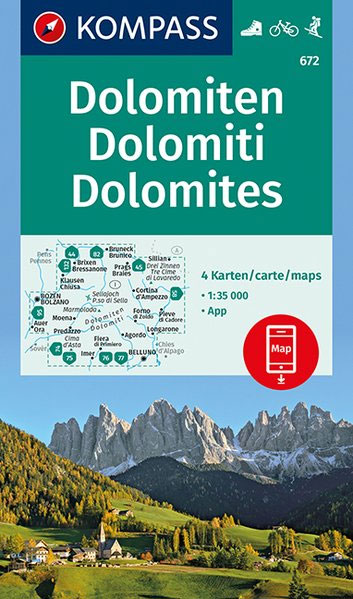
The heart of the Dolomites on four double-sided, contoured and GPS compatible. recreational maps at 1:35,000 from Kompass highlighting hiking trails including the Alte Vie, mountain bike routes, various types of tourist accommodations, recreational facilities, etc. The set provides very wide coverage of the mountains, extending eastwards from Bolzano to well beyond Cortina d’Ampezzo and from Brunico/Bruneck in the north to Belluno, including the most popular of the High Routes (Alte Vie), Val Gardena, Marmolada massif, etc.Topography is vividly present by contours at 40m or 50m intervals enhanced by numerous spot heights, shading and graphic relief, plus colouring and/or graphics for different types of vegetation. National parks and other protected areas are marked. Extensive overprint highlights numerous hiking trails, indicating where appropriate difficult and/or via ferrata sections, also their waymarking numbers or symbols for the long-distance trails (including the Alte Vie, Sentiero Italia, Via Alpina, etc). Also marked are cycling and mountain biking routes (including Via Claudia Augusta), horse riding trails, plus cross-country and selected alpine ski routes. A very wide range of symbols indicates various accommodation options (hotels and inns, huts, campsites, youth hostels, etc), cycle hire and repair shops, sport and recreational facilities, etc. Road network shows toll routes, car parks and Park+Ride facilites, and all forms of mountain transport are included (cable cars, chair lifts, etc). The maps have a 1km UTM grid. Map legend includes English.To see the list of other titles in this series please click on the series link.

Related Products:
 Italy: Kompass 25K/40K Hiking Maps of the Dolomites
 South Tyrol – Dolomites 4-Map Set Kompass 699
 Lienz Dolomites – Lesachtal – Carnic High Trail Kompass 47
 South Tyrol Kompass Hiking & Recreational Kompass Ring-binder Atlas No. 2703: Bormio – Merano – Bolzano – Cortina d`Ampezzo
 Italy: Tabacco 25K Walking Maps of the Dolomites and North-Eastern Italy
 Alsace – Vosges Central – Strasbourg – Colmar 2-Map Set Kompass 2221
 Alsace – Vosges South – Colmar – Mulhouse 2-Map Set Kompass 2222
 Alsace – Vosges North – Hagenau – Starsburg 2-Map Set Kompass 2220
 Regglberg – Latemar – Val d`Ega / Eggental Kompass 630
 Trentino 3-Map Set Kompass 683
 Monte Baldo North – Bretonico – Malcesine Kompass 691
 Alto Garda – Ledro – Valle del Sacra Kompass 096
 Slovenia: Kompass 75K Hiking and Cycling Maps
 Maribor – Pomurje – Drava Valley Kompass 2802
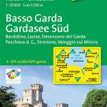 Lake Garda South – Bardolino – Lazise – Desenzano del Garda Kompass 695
 Alto Garda and Ledro – Riva del Garda – Malcesine – Torbole – Limone sul Garda Kompass 690
 Elba Kompass 2468
 Lienz Dolomites – Lesachtal – Villgratner Berge F&B WK182
 Corsica South 3-Map Set Kompass 2251
 Corsica North 3-Map Set Kompass 2250
 Lake Garda: Trento – Brescia – Verona 35K Kompass Hiking Atlas No. 2752
 Tenerife Kompass 233
 Gran Canaria Kompass 237
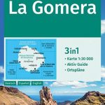 La Gomera Kompass 231
Sardinia Central 4-Map Set Kompass 2498
La Gomera Kompass 231
Sardinia Central 4-Map Set Kompass 2498
 Sardinia South 4-Map Set Kompass 2499
 Sardinia North 4-Map Set Kompass 2497
 Lake Garda and its Surroundings 3-Map Set Kompass 697
 Alpi Bellunesi Kompass 77
Julian Alps – Steiner Alps – Kamnik Alps Kompass 2801
Alpi Bellunesi Kompass 77
Julian Alps – Steiner Alps – Kamnik Alps Kompass 2801
 Italy: F&B Walking Maps of the Dolomites
Val Pusteria / Pustertal 3-Map Set Kompass 671
Italy: F&B Walking Maps of the Dolomites
Val Pusteria / Pustertal 3-Map Set Kompass 671
 Mallorca Hiking Atlas Kompass 2753
 Bolzano and Environs Kompass 54
 Val Venosta / Vinschgau Kompass 52
 Bressanone / Brixen Kompass 56
 Stuttgart and Environs 2-Map Set Kompass 780
Spessart 2-Map Set Kompass 832
Adamello – La Presanella Kompass 71
Stuttgart and Environs 2-Map Set Kompass 780
Spessart 2-Map Set Kompass 832
Adamello – La Presanella Kompass 71
 Ausseerland – Ennstal – Tauplitz Kompass 68