Disclosure : This site contains affiliate links to products. We may receive a commission for purchases made through these links.
DK Eyewitness Canary Islands
Related Products:
 DK Eyewitness Travel Guide Canary Islands
 Iberian Peninsula – Balearic Islands – Canary Islands CNIG Physical Wall Map
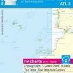 ATL3 Atlantic Islands: Azores, Madeira, Canary Islands, Cape Verde – 2018/19 Edition
 Lonely Planet Canary Islands
 Canary Islands Globetrotter Travel Guide
 Berlitz Pocket Guide Canary Islands
 Insight Guides Pocket Canary Islands
 Canary Islands II: Tenerife and La Gomera – Spain: II
 Canary Islands
 Canary Islands Cruise Ports Marco Polo Pocket Guide – with pull out maps
 Canary Islands ITMB
 Canary Islands Michelin Zoom 125
 Canary Islands: A Cultural History
 Cruising Guide to the Canary Islands
 A Birdwatchers` Guide to the Canary Islands
 The Canary Islands: A Cultural History
 Canary Islands CNIG RAISED RELIEF Map
 Canary Islands: Fuerteventura and Lanzarote – Spain: Vol. 1
 Spain: Kompass Maps of the Canary Islands
 Spain: 50K Canary Islands Civilian Topographic Survey
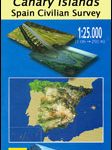 Spain: 25K Canary Islands Civilian Topographic Survey
 Trekking in the Canary Islands: The GR131 island-hopping route
 Canary Islands Autonomous Region 350K CNIG Physical Road Map
 Canary Islands East: Gran Canaria, Fuerteventura, Lanzarote 500K CNIG Regional Map No.
 Canary Islands West: Gran Canaria, Tenerife, La Palma, Gomera, Hierro 500K CNIG Regional Map No. 14
 DK Eyewitness Top 10 Greek Islands
 DK Eyewitness Greek Islands
 Wildlife of Madeira and the Canary Islands: A Photographic Field Guide to Birds, Mammals, Reptiles, Amphibians, Butterflies and Dragonflies
 DK Eyewitness Top 10 Corfu and the Ionian Islands
 DK Eyewitness Travel Guide The Greek Islands
 DK Eyewitness Travel Guide Thailand`s Beaches & Islands
 Admiralty Chart Folio 20 – Northwest Coast of Africa – Strait of Gibraltar to Sierra Leone incl. Madeira, Canary, and Cape Verde Islands
 NOAA Chart 16540 – Shumagin Islands to Sanak Islands – Mist Harbor
 Admiralty Chart 4629 – Samoa Islands to Northern Cook Islands and Tokelau
 Admiralty Chart 4630 – Samoa Islands to Southern Cook Islands
 Admiralty Chart 3200 – Falkland Islands to South Sandwich Islands and Graham Land
 NOAA Chart 81092 – Commonwealth of the Northern Mariana Islands’”Pagan Island – Maug Islands
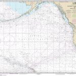 NOAA Chart 530 – North America West Coast’”San Diego to Aleutian Islands and Hawai’ian Islands
 NOAA Chart 530 – San Diego to Aleutian Islands and Hawai’ian Islands
 Admiralty Chart PNG398 – Tulun Islands to Tanga Islands


