Disclosure : This site contains affiliate links to products. We may receive a commission for purchases made through these links.
Discover the Isle of Bute
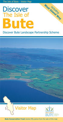
The Isle of Bute on a contoured and GPS compatible map at 1:30,000 from Footprint Walks, with a street plan of Rothesay, plus on the reverse extensive tourist information including description of sights, useful contact details, etc. Produced in cooperation with the Discover Bute Landscape Partnership Scheme, the map highlights additional hiking routes recommended by DBLPS and indicates sections of the West Island Way where waymarking on the ground is difficult to follow.Topography is very effectively presented by contours at 10m intervals enhanced by relief shading plus colouring for woodlands. Symbols indicate various facilities including pubs and cafes, shops, public toilets, etc. Ferry connections are marked. The map has 1km lines of the British National Grid. A street plan of Rothesay shows main facilities in the town. The whole of the reverse side is covered by tourist information: getting to and around the island, places of interest, hiking and cycling, beaches, etc. Where useful, contact details and related web addresses are provided.

Related Products:
 Discover the Isle of Mull – Including Isles of Iona, Ulva & Gometra
 Cowal West & Isle of Bute – Rothesay OS Explorer Map 362 (paper)
 Cowal West & Isle of Bute – Rothesay OS Explorer Active Map 362 (waterproof)
 Loch Lomond & Cowal Way: with Isle of Bute
 The Isle Of Bute
 Argyll & Bute Nicolson Tourist Map
 Discover Cairngorms National Park
 Admiralty Chart SC5610_6 – Plans in the Kyles of Bute
 Arran, Bute and Kintyre Pocket Map – The perfect way to explore the Firth of Clyde
 Isle of Wight A-Z Adventure Atlas
 Bicycle Island – Isle of Wight Heritage House Cycle Map
Rothesay 1886 – 204.06
Walking Argyll and Bute (12)
Bicycle Island – Isle of Wight Heritage House Cycle Map
Rothesay 1886 – 204.06
Walking Argyll and Bute (12)
 Palma de Mallorca City Map / Mallorca Road Map
 Argyll and Bute Pevsner Architectural Guide
 Easter Island / Rapa Nui
 Hampshire & Isle of Wight Sustrans Cycle Map 6
 Thasos Terrain Editions 323
 Old City of Jerusalem Map
 Menorca
 Isle of Wight AA Walker`s Map 16
 Elba Global Map Tourist Map
 West of Scotland Sea Kayaking Map
 Lisburn City OSNI Street Plan
 Bergen Cappelen Street Plan
 Argyll and Bute c1882
 Smolyan – Chepelare – Pamorovo and the Surrounding Area
 Ikaria Terrain Editions 332
 Guangzhou & China South ITMB
 Stockholm Tourist Map
 Armagh City OSNI Street Plan
 CHS Chart 3542 – Bute Inlet
 New Orleans
 Folegandros Terrain Editions 316
 Auckland & North Island ITMB
 Greater Oslo Cappelen Street Plan
 Chios Terrain Editions 328
 Nisyros Terrain Editions 339
 Mykonos – Delos – Rinia Terrain Editions 309
 Hong Kong Marco Polo City Map