Disclosure : This site contains affiliate links to products. We may receive a commission for purchases made through these links.
Denmark Reise Know-How

Denmark at 1:300,000 on an indexed, waterproof and tear-resistant road map with topographic and tourist information, published by Reise Know-How as part of their highly acclaimed World Mapping Project. The map is double-sided, with a good overlap between the sides, to provide the best balance between a good scale and a convenient size sheet.The country’s road and rail networks are easy to see on a clear base with light altitude colouring. Ferry connections between the islands are also indicated. Protected nature reserves are marked and symbols highlight various places of interest including viewpoints, campsites, beaches and marinas, golf courses, historical and cultural sites, etc. The map has both a UTM grid and a latitude/longitude grid at intervals of 20’, plus an extensive index of localities. Map legend includes English.

Related Products:
 Mauritius – Reunion – Rodrigues Reise Know-How
 Estonia Reise Know-How
 Denmark Road Atlas
 Denmark Hallwag Road Map
 Denmark F&B
 Trinidad and Tobago Reise Know-How
 Istria Reise Know-How
 Mozambique – Malawi Reise Know-How
 South Africa Reise Know-How
 Stockholm County Norstedts Road Map
 Jamaica Reise Know-How
 Denmark Marco Polo Map
 Lithuania Reise Know-How
 Romania – Moldova Reise Know-How
 Tanzania Reise Know-How
 Bhutan Reise Know-How
 Western Balkans Reise Know-How
 Bolivia Reise Know-How
 Baja California Reise Know-How
 Madagascar Reise Know-How
 Slovenia Reise Know-How
 Corfu Reise Know-How
 Cambodia Reise Know-How
 Vietnam North Reise Know-How
 Zambia Reise Know-How
 Serbia – Montenegro – Kosovo Reise Know-How
 Cyprus Reise Know-How
 Algarve Reise Know-How
 Cape Verde Islands Reise Know-How
 Baltic States Reise Know-How
 Bulgaria Reise Know-How
 Denmark South – Kolding – Copenhagen – Bornholm K+F Regional Road Map
 Denmark K+F Road Map
 Hawaii Reise Know-How
 Dominican Republic – Haiti Reise Know-How
 Venezuela Reise-Know-How Map
 Cape Region – South Africa Reise Know-How
 Zimbabwe Reise Know-How
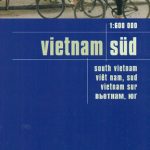 Vietnam South Reise Know-How
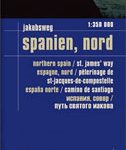 Spain North – Santiago Route Reise Know-How