Disclosure : This site contains affiliate links to products. We may receive a commission for purchases made through these links.
Delhi Street Atlas
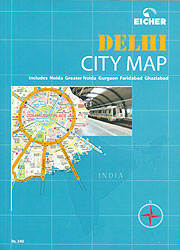
Delhi in a paperback, 17x24cm, 315-page paperback street atlas at 1:12,500, including the neighbouring Noida, Gurgaon, Ghaziabad and Faridabad, with details including house numbers, plus an index listing 15,000 roads, colonies, important buildings, places of interest, etc. The atlas has very well designed, clear cartography, with colours indicating residential and industrial areas, slums (Jhuggi Jhompri Clusters), shopping streets and centres, parks and gardens, and wooded areas. Names of colonies and villages are shown with, where appropriate, designation of their zones and house numbers. Street information includes dual carriageways, flyovers and underpasses, one way streets, traffic lights and pedestrian subways. Railway and metro lines are shown with stations. A very vide range of symbols indicate various facilities and places of interest, including embassies, banks, taxi stands, fuel supplies, monuments and museums, restaurants and hotels, places of worship, police stations, post offices, electricity/water/sewer complaint offices, etc. The index lists over 15,000 roads, colonies, important buildings, places of interest, etc.


