Disclosure : This site contains affiliate links to products. We may receive a commission for purchases made through these links.
Dartford and Gravesend 1893
Dartford and Gravesend in 1893 in a series of reproductions of Ordnance Survey’s famous “Inch to the Mile” maps published in the Alan Godfrey Editions to provide a historical record of England and Wales in the second half of 19th and early 20th century.The map covers an area from Bromley eastward to Gravesend and from Erith southward to Halsted, with north of the Thames a small portion of Essex around Tilbury and Grays. Coverage also includes: in ESSEX Chadwell St Mary`s, Grays, Little Thurrock, Purfleet, Tilbury, West Thurrock, and West Tilbury; plus in KENT Ash, Bexley, Bromley, Chalk, Charlton, Chelsfield, Chislehurst, Cobham, Crayford, Eltham,Erith, Eynsford, Farnborough, Farningham, Fawkham, Foots Cray, Greenhithe, Halsted, Hartley, Hayes, Horton Kirkby, Keston, Kidbrooke, Kingsdown, Longfield, Luddesdown, Lullingstone, Meopham, Mottingham, North Cray, Northfleet, Nursted, Orpington, Plumstead, Ridley, Shinglewell, Shoreham, St Mary Cray, St Paul`s Cray, Stansted, Stone, Sutton at Hone, Swanley, Swanscombe, Welling, Wilmington, and Woolwich. On the reverse is a more detailed map of the centre of Betsham, including Southfleet station.*About the Alan Godfrey Editions of the OS Inch to the Mile Maps:* The maps provide an invaluable overview of a wider area, typically 18 x 12 miles (29 x 19 kms approx.), and offer historical mapping for small towns and villages not covered by the more detailed series for which the Godfrey Editions are better known. On the reverse all the maps have historical notes and most titles also include a more detailed, large scale map of a small town or a village in the area.To see other titles in this series please click on the series link.

Related Products:
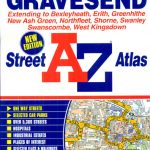 Dartford – Gravesend A-Z Street Atlas
 North East Essex and Dedham Vale 1904
 Gravesend 1865
The Medway Towns 1893
Gravesend 1865
The Medway Towns 1893
 Romford & SW Essex 1893 – 257
South West Suffolk 1893
Isle of Thanet 1893 – 274
Romford & SW Essex 1893 – 257
South West Suffolk 1893
Isle of Thanet 1893 – 274
 Bromley Common and North-East Hayes 1895
Tenterden & District 1893 – 304
Bromley Common and North-East Hayes 1895
Tenterden & District 1893 – 304
 Bromley North and Sundridge Park 1895
Sevenoaks and Tonbridge 1893
Ipswich, Bildeston and District 1893
Swindon, Highworth and District 1893
Bromley North and Sundridge Park 1895
Sevenoaks and Tonbridge 1893
Ipswich, Bildeston and District 1893
Swindon, Highworth and District 1893
 St. Andrews 1893 – 9.10
Poole Harbour and Bournemouth 1893
South London 1893
South East Essex 1884
Alton and District 1893
St. Andrews 1893 – 9.10
Poole Harbour and Bournemouth 1893
South London 1893
South East Essex 1884
Alton and District 1893
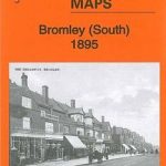 Bromley South 1895
Oxford, Witney and District 1893
Bromley South 1895
Oxford, Witney and District 1893
 Paddington 1893 – 60.2
Biggleswade, Sandy and Royston 1893
Glasgow North East 1893
Leytonstone 1893 – 23.2
Plymouth North 1893
Bow, Bromley & West Ham 1867 – 53.1
Colne Valley and Braintree 1887
Springburn and Possilpark 1893
Kelvinside 1893
North London 1902-13 – 256
Middlesbrough North 1893 (Colour Edition)
Vale of White Horse 1893
Paddington 1893 – 60.2
Biggleswade, Sandy and Royston 1893
Glasgow North East 1893
Leytonstone 1893 – 23.2
Plymouth North 1893
Bow, Bromley & West Ham 1867 – 53.1
Colne Valley and Braintree 1887
Springburn and Possilpark 1893
Kelvinside 1893
North London 1902-13 – 256
Middlesbrough North 1893 (Colour Edition)
Vale of White Horse 1893
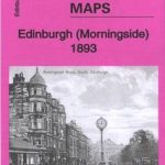 Morningside 1893 – 3.15
Devonport North 1893
Isles of Scilly 1896
Glasgow East End 1893
Foulness and Mersea 1904
Morningside 1893 – 3.15
Devonport North 1893
Isles of Scilly 1896
Glasgow East End 1893
Foulness and Mersea 1904
 North Hammersmith & Bedford Park 1893 – 72.2
North Kent Coast 1878
North Hammersmith & Bedford Park 1893 – 72.2
North Kent Coast 1878
 Shoreditch 1893 – 51.2