Disclosure : This site contains affiliate links to products. We may receive a commission for purchases made through these links.
Darlington West 1898
Darlington West in 1898 in a fascinating series of reproductions of old Ordnance Survey plans in the Alan Godfrey Editions, ideal for anyone interested in the history of their neighbourhood or family. The map is double-sided. The main map covers an area from Stanhope Green and Larchfield Street near the town centre westward to Mowden and Hillclose House, and from Bell Lane southward to Duke Street. Features include St Clare`s Abbey, Stanhope Green, Pierremont, Brinkburn, St Joseph`s School, horse tramway along Woodlands Road, West Lodge, Carmel House Convent, Pierremont Park Nursery, etc. Part of Cockerton is on the map, including The Green. On the reverse is half of the adjacent sheet 55.09 extending coverage south and this includes Coniscliffe Road as far west as Carmel Road. Blackwell Hall is near the south-west corner. Features include Blackwell Grange, Blackwell Mill, Harewood Hill and West Cemetery.About the Alan Godfrey Editions of the 25″ OS Series:Selected towns in Great Britain and Ireland are covered by maps showing the extent of urban development in the last decades of the 19th and early 20th century. The plans have been taken from the Ordnance Survey mapping and reprinted at about 15 inches to one mile (1:4,340). On the reverse most maps have historical notes and many also include extracts from contemporary directories. Most maps cover about one mile (1.6kms) north/south, one and a half miles (2.4kms) across; adjoining sheets can be combined to provide wider coverage.FOR MORE INFORMATION AND A COMPLETE LIST OF ALL AVAILABLE TITLES PLEASE CLICK ON THE SERIES LINK.

Related Products:
 Darlington (South) 1898 – 55.10a
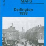 Darlington 1898 – 55.06a
 Newbury 1898 – 43.01
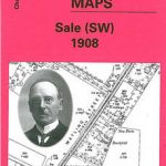 Sale South-West 1908
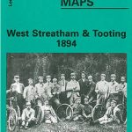 West Streatham & Tooting 1894 – 135a
 Wallasey Village 1898
Worcester South-West 1902
South Oxford 1898 – 39.03
Wallasey Village 1898
Worcester South-West 1902
South Oxford 1898 – 39.03
 Shrewsbury West 1900
Kensal Green & West Kilburn 1865 – 47.1
Worcester North-West 1902
Ipswich South-West 1902
Shrewsbury West 1900
Kensal Green & West Kilburn 1865 – 47.1
Worcester North-West 1902
Ipswich South-West 1902
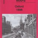 Oxford 1898 – 33.15
Maldon West 1920 – 55.16
Blackburn West 1929
Friern Barnet and New Southgate 1898
West Norwood 1894 – 136.2
Oxford 1898 – 33.15
Maldon West 1920 – 55.16
Blackburn West 1929
Friern Barnet and New Southgate 1898
West Norwood 1894 – 136.2
 West Norwood 1913 – 136.3
Rutherglen West and Polmadie 1910
West Norwood 1913 – 136.3
Rutherglen West and Polmadie 1910
 The West End 1894 – 61.2
Bangor West 1901
Colwyn Bay South West 1911
Carlisle South-West 1924
Dundee West 1901
The West End 1914 – 61.3
The West End 1894 – 61.2
Bangor West 1901
Colwyn Bay South West 1911
Carlisle South-West 1924
Dundee West 1901
The West End 1914 – 61.3
 West Drayton South 1935
 Falkirk 1898
West Twickenham & Strawberry Hill 1894 – 121a
Falkirk 1898
West Twickenham & Strawberry Hill 1894 – 121a
 West Twickenham & Strawberry Hill 1934 – 121b
Wolverhampton North West 1901
Wigan West 1908
Leicester South West 1902-1911
West Twickenham & Strawberry Hill 1934 – 121b
Wolverhampton North West 1901
Wigan West 1908
Leicester South West 1902-1911
 Chelsea & West Brompton 1894 – 87.2
Duns & Greenlaw 1898 – 16.07
Inverness West 1903
Swindon South-West 1899
Great Malvern and West Malvern 1926
Bow, Bromley & West Ham 1867 – 53.1
Chelsea & West Brompton 1894 – 87.2
Duns & Greenlaw 1898 – 16.07
Inverness West 1903
Swindon South-West 1899
Great Malvern and West Malvern 1926
Bow, Bromley & West Ham 1867 – 53.1
 St Albans South-West 1897
West Hartlepool 1914 – 37.11c
St Albans South-West 1897
West Hartlepool 1914 – 37.11c