Disclosure : This site contains affiliate links to products. We may receive a commission for purchases made through these links.
Danube Bend Cycle Atlas & Guide
The Danube Bend, one of Hungary’s most popular tourist destinations, in an A5 spiral-bound cycling atlas from the Budapest-based Frigoria with contoured, GPS compatible mapping at 1:50,000 highlighting cycle and mountain bike routes, rental and maintenance shops, accommodation options, etc, plus a guide to the area which includes English. Coverage extends from Esztergom to Budapest, including the local section of the EuroVelo Danube Cycle Route.The maps have contours at 10m intervals, spot heights and colouring to indicate woodlands. The overprint shows whether the route is on a bike lane, a separate cycle path, a dirt road, a woodland trail, etc. Steep gradients are shown by additional markings and cycling distances are indicated. Where appropriate, the routes are cross-referenced to the guide section. The mapping also shows local hiking paths indicating their waymarking signage. Symbols show hotels, motels, pensions, tourist or youth hostels, campsites, bike hire and/or repair shops, tourist information offices, interesting natural or historic sites, etc. Railway lines are shown with stations and bus terminals are marked. The maps have latitude and longitude lines at intervals of 2’. Central Esztergom, Vรกc, Veroce and Szentendre also covered by street plans.The tri-lingual guide section provides general information about the area including access on routes from Budapest, descriptions and route profiles of 15 cycle and 10 mountain bike tours, plus descriptions of local places of interest which include dates of special events and useful contact details.Map legend and all the text include English.

Related Products:
 Budapest & the Danube Bend (Pilis – Visegrรกd) Atlas
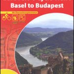
 EuroVelo 6 – Danube Bike Trail – Basel to Budapest Cycle Trail 7-Map Set
 Danube Cycle Route Part 3: Vienna – Bratislava – Budapest (334km) Bikeline Map/Guide ENGLISH Ed.
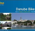 Danube Cycle Route Part 4: Budapest – Belgrade (570km) Bikeline Map/Guide ENGLISH Ed.
 Danube Cycle Route Part 5: Belgrade – Black Sea (1400km) Bikeline Map/Guide ENGLISH Ed.
 Danube-Lake Constance Cycle Route – Upper Swabia-Allgรคu Cycle Route Bikeline Map-Guide
 Danube Bend Cartographia Tourist Map 31
 Via Claudia Augusta Cycle Route – from the Danube to the Adriatic Bikeline Map-Guide
 Isar Cycle Route – Scharnitz to the Danube Bikeline Map-Guide
 Danube Cycle Route Part 1: Donaueschingen to Passau ENGLISH Ed.
 Tauern Cycle Route: Krimml via Salzburg to the Danube (320km) Bikeline Map/Guide ENGLISH Ed.
 Roman Border (Limes) Cycle Route: the Rhine to the Danube (816km) Bikeline Map/Guide
 Danube Cycle Route Volume 1 (From the source in the Black Forest to Budapest)
 Five Rivers Cycle Tour – Naab – Vils – Pegnitz – Altmuhl – Danube Bikeline Map-Guide
 France Chamina Edition Greenways and Cycle Routes Atlas
 Enns Cycle Route: from the Source to the Danube (264km)
 Danube Cycle Route Part 2: Passau to Vienna ENGLISH Ed.
 Lake Balaton Cycling Atlas
 EuroVelo 6 – Danube Bike Trail – Budapest to the Black Sea 8-Map Set
 Rhine Cycle Route 3 – Basel – Speyer Publicpress Cycle Touring 368
 Danube Valleys Cycle Route Bikeline Map-Guide Compact
 Mรผnsterland Cycle Route Bikeleine Map-Guide
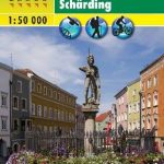 Danube Cycle Trail – Passau – Eferding – Sauwald – Schรคrding F&B WK432
Rhine Cycle Route 4 – Speyer – Cologne Publicpress Cycle Touring 333
Rhine Cycle Route 2 – Lake Constance – Basel Publicpress Cycle Touring 302
Danube Cycle Trail – Passau – Eferding – Sauwald – Schรคrding F&B WK432
Rhine Cycle Route 4 – Speyer – Cologne Publicpress Cycle Touring 333
Rhine Cycle Route 2 – Lake Constance – Basel Publicpress Cycle Touring 302
 Iller Cycle Route – Zusam Cycle Route Bikeline Map-Guide
Ems Cycle Route – Senne to North Sea – incl. Dortmund-Ems Canal Bikeline Map-Guide
Iller Cycle Route – Zusam Cycle Route Bikeline Map-Guide
Ems Cycle Route – Senne to North Sea – incl. Dortmund-Ems Canal Bikeline Map-Guide
 Cycling Northern France: Cycle Routes North of the Loire
 Rhine Cycle Route 3 – Mainz to Duisburg Bikeline Map-Guide
Rhine Cycle Route 4 – Cologne to Hoek van Holland Bikeline Map-Guide
Inn Cycle Route 2 – Innsbruck to Passau Bikeline Map-Guide
Rhine Cycle Route 3 – Mainz to Duisburg Bikeline Map-Guide
Rhine Cycle Route 4 – Cologne to Hoek van Holland Bikeline Map-Guide
Inn Cycle Route 2 – Innsbruck to Passau Bikeline Map-Guide
 Prague – Vienna Cycle Greenway (464km)
 The Danube Cycleway: From Budapest to the Black Sea: Volume 2
Venice to Rome Cycle Route Bikeline Map-Guide
The Danube Cycleway: From Budapest to the Black Sea: Volume 2
Venice to Rome Cycle Route Bikeline Map-Guide
 Havel Cycle Route Bikeline Map-Guide
 Mecklenburg Lakes Cycle Region Bikeline Map-Guide
 Baltic Coast Cycle Route Part 3: Usedom – Gdansk (480km) Bikeline Map/Guide
 Hungary – Budapest Road Atlas SPIRAL-BOUND
 EuroVelo 6 Cycle Trail: Basel to Budapest
 Brandenburg Cycle Region Esterbauer Map-Guide