Disclosure : This site contains affiliate links to products. We may receive a commission for purchases made through these links.
Damaraland
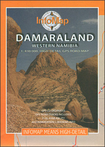
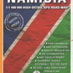
Damaraland in Namibia at 1:430,000 on a road map from the South African publishers International Motoring Productions, annotated with numerous GPS waypoints for selected road junctions, settlements and recommended accommodation. Coverage starts just south of Swakopmund and extends northwards to 19ยบ, just beyond Kamanjab.Road classification indicates tarred roads, major and minor gravel roads and 4WD tracks, with driving distances marked on most routes and locations of fuel stations. GPS waypoints for road junctions are marked directly on the map; campsites and other accommodation options are named, with their GPS coordinates listed in a separate table.Symbols indicate locations with access by air and/or tourist lodges and campsites, plus various points of interest. Rather simple cartography has basic elevation tinting and occasional spot heights; seasonal rivers are marked and main mountain ranges are named. Coverage further north is provided by the publishers’ map of Kaokoland which overlaps with this title.


