Disclosure : This site contains affiliate links to products. We may receive a commission for purchases made through these links.
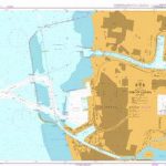
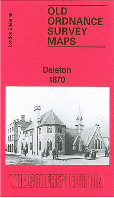
Dalston 1870 – 40.1
Dalston in 1870 in a fascinating series of reproductions of old Ordnance Survey plans in the Alan Godfrey Editions, ideal for anyone interested in the history of their neighbourhood or family. Three versions of this map cover the same area, stretching from Essex Road eastward to London Fields, and from Shacklewell Lane southward to De Beauvoir Crescent; a varied and very busy area, comprising De Beauvoir Town, Kingsland and Balls Pond at the west, Dalston and west Hackney to the east. The North London Railway forms a T-shape across the map, including Dalston Junction and Haggerston stations, while on the later maps the GER line runs down the eastern side, including London Fields and Hackney Downs stations. Kingsland Road and Kingsland High Street run north-south through the centre of the map. Other features include De Beauvoir Square, Kingsland Basin, Bricklayers Almshouses, Dyers Almshouses, Balls Pond Road, Mildmay Compound, German Hospital, Militia Barracks, etc.About the Alan Godfrey Editions of the 25″ OS Series:Selected towns in Great Britain and Ireland are covered by maps showing the extent of urban development in the last decades of the 19th and early 20th century. The plans have been taken from the Ordnance Survey mapping and reprinted at about 15 inches to one mile (1:4,340). On the reverse most maps have historical notes and many also include extracts from contemporary directories. Most maps cover about one mile (1.6kms) north/south, one and a half miles (2.4kms) across; adjoining sheets can be combined to provide wider coverage.FOR MORE INFORMATION AND A COMPLETE LIST OF ALL AVAILABLE TITLES PLEASE CLICK ON THE SERIES LINK.

Related Products:
 Dalston 1894 – 40.2
 Dalston 1913 – 40.3
 Hackney 1870 – 41.1
 Dalston Monsterzz
 Battersea & Clapham 1870 – 101.1
 Cased Dissected Map Stanfords Victorian London Section 3
 Stepney & Limehouse 1870 – 64.1
Bethnal Green & Bow 1870 – 52.1
Hackney 1913 – 41.3
Stepney & Limehouse 1870 – 64.1
Bethnal Green & Bow 1870 – 52.1
Hackney 1913 – 41.3
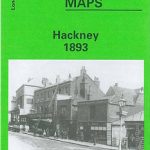 Hackney 1893 – 41.2
 Brixton & Herne Hill 1870 – 116.1
 Clapham Common 1870 – 115.1
 Ealing 1913
 Shrewsbury West 1900
 Finsbury Park & Stroud Green 1870 – 20.1
Euston & Regent`s Park 1870 – 49.1
Finsbury Park & Stroud Green 1870 – 20.1
Euston & Regent`s Park 1870 – 49.1
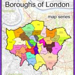 London: Hackney Borough Map – Stanfords Print on Demand
 Bristol: Bartholomew`s Street Plan c.1870 MEDIUM
 Bristol: Bartholomew`s Street Plan c.1870 SMALL
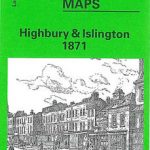 Highbury & Islington 1871 – 39.1
 Rotherhithe 1894 – 78.2
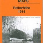 Rotherhithe 1914 – 78.3
 Iceland North-West IDNU 1
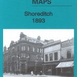 Shoreditch 1893 – 51.2
Shoreditch 1872 – 51.1
Shoreditch 1893 – 51.2
Shoreditch 1872 – 51.1
 Shoreditch 1914 – 51.3
 Rotherhithe 1868 – 78.1
 Finland West Karttakeskus Road Map
 London Michelin Citymap
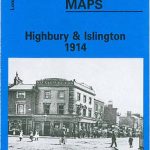 Highbury & Islington 1914 – 39.3
 Highbury & Islington 1894 – 39.2
 London: Froggets 30 miles round London MEDIUM
Kirkby Lonsdale and District 1870
London: Froggets 30 miles round London MEDIUM
Kirkby Lonsdale and District 1870
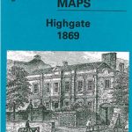 Highgate 1869 – 19.1
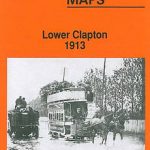 Lower Clapton 1913 – 31.3
 Stanford`s Map of the Environs of Paris (1870) – A3 Wall Map, Canvas
Stanford`s Map of the Environs of Paris (1870) – A2 Wall Map, Canvas
Stanford`s Map of the Environs of Paris (1870) – A1 Wall Map, Canvas
Stanford`s Map of the Environs of Paris (1870) – A3 Wall Map, Canvas
Stanford`s Map of the Environs of Paris (1870) – A2 Wall Map, Canvas
Stanford`s Map of the Environs of Paris (1870) – A1 Wall Map, Canvas
 50 Miles Around London A-Z Map
Stanford`s Map of the Environs of Paris (1870) – A1 Wall Map, Paper
50 Miles Around London A-Z Map
Stanford`s Map of the Environs of Paris (1870) – A1 Wall Map, Paper