Disclosure : This site contains affiliate links to products. We may receive a commission for purchases made through these links.
Dalmatian Coast North – Krk ‘“ Cres ‘“ Loลกinj ‘“ Rab ‘“ Pag – Zadar Kompass 2901

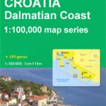
Dalmatian Coast North: Krk – Cres – Loลกinj – Rab – Pag – Zadar on a waterproof and tear-resistant, double-sided, detailed and GPS compatible map at 1:100,000 from Kompass, prominently highlighting places of interest and various facilities. Coverage extends from Rijeka southwards to beyond Biograd and Lake Vransko on the mainland and includes the Kornat National Park archipelago.Maps in this Kompass 100K series covering the Dalmatian Coast have contours at 40m intervals, enhanced by relief shading and spot heights. Road network includes unsurfaced country roads and cart tracks, and indicates locations of petrol stations. Railway lines are shown with stations and ferry routes are marked. An overprint highlights a selection of waymarked hiking trails. Picturesque towns and villages are also highlighted and symbols mark various places of interest, including selected hotels, campsites and mountain huts, viewpoints, cultural and archaeological sites, harbours and marinas, restricted anchorage sites and locations of nautical fuel suppliers, etc. The legend, conveniently placed on each side of the map, includes English.PLEASE NOTE: this title is available either separately or as part of a 3-map set ‘“ PLEASE CLICK ON THE SERIES LINK TO SEE THE LIST OF ALL THE TITLES. For convenience, we have also listed with this series Kompass map of Istria at 1:75,000 (No. 238) which has the publishers’ traditional cartography, markedly different from the other three maps (Nos. 2901 ‘“ 2903).


