Disclosure : This site contains affiliate links to products. We may receive a commission for purchases made through these links.
Dalmatia 2-Map Set

The Dalmatian Coast of the Adriatic on a set of two double-sided road maps at 1:100,000 from the Ljubljana-based Kartografija with good presentation of the topography of the islands and of the adjoining mainland, car ferry connections, etc. Coverage starts from the central part of Pag and on the mainland from north of Karlobag, so please note that the northern islands (Krk, Cres Rab and Loลกoi) are not included.Bold altitude colouring with relief shading and contour lines shows the topography. Road network includes cart tracks, shows locations of petrol stations and gives driving distances on main and many local roads. Also shown are selected footpaths, indicating waymarked routes. Railway lines are shown with stations and car ferry routes are also marked. Symbols indicate various facilities and places of interest including campsites, nudist campings, marinas and nautical fuel supplies, etc. The map have latitude and longitude lines at 5’ intervals. Map legend includes English.

Related Products:
 Dalmatia – Istria
 Slovenia – Istria
 Azores F&B
 Denmark South – Kolding – Copenhagen – Bornholm K+F Regional Road Map
 South Jutland and Funen – Esbjerg – Odense
 Azerbaidjan
 Montenegro F&B
 Ibiza – Formentera F&B
 Dalmatia – Croatia Coast Central and South
 Finland Road Atlas GLOVEBOX, SPIRAL-BOUND
 Mallorca – Ibiza – Menorca – Formentera K+F Road Map
 Madagascar F&B
 Istria – Kvarner
 Poland: Carta Blanca/Kompas Road Atlas 2015 GLOVEBOX, SPIRAL-BOUND
 Philippines Reise Know-How
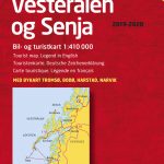 Lofoten – Vesteralen Islands – Senja Cappelen Sectional Road Map
 Slovenia, Croatia and Bosnia-Herzegovina
 Crete Michelin
 Greece Anavasi Road Map
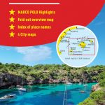 Mallorca – Ibiza – Formentera – Menorca Marco Polo Map
 Croatia F&B
 New England – Hudson Valley Michelin Regional 581
 Poland North
 Poland South
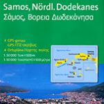 Samos & Northern Dodecanese Islands 50K Kompass Map No.253
 Latvia: Jana Seta 100K Adventure Road Atlases
 Finland South Karttakeskus Road Map
 Greece Terrain Editions
 Estonia
 Cap of the North / Nordkalotten Norstedts Road Map
 Japan F&B
Italy F&B Great Road Atlas SPIRAL-BOUND
Japan F&B
Italy F&B Great Road Atlas SPIRAL-BOUND
 Estonia Jana Seta Road Atlas
 Pyrenees Reise Know-How
 Midatlantic – Allegheny Highlands Michelin Regional 582
 Kefalonia – Ithaca F&B
Belarus (Cyrillic edition)
Kefalonia – Ithaca F&B
Belarus (Cyrillic edition)
 Scotland Reise Know-How
 Croatia – Montenegro Coast Cartographia 2-Map Set
 Middle East F&B