Disclosure : This site contains affiliate links to products. We may receive a commission for purchases made through these links.
Czech – Slovak Republics F&B Superatlas
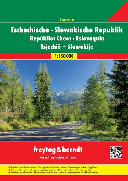
Road Atlas of the Czech Republic and Slovakia at 1:150,000 from Freytag & Berndt, presenting each county separately and accompanied by street plans and enlargements for main urban areas, plus mapping of the whole of Europe for route planning.The atlas, published in an A4 spiral-bound format, presents each country on a separate set of maps, with cartography of both sections provided by F&B’s Czech subsidiary Shocart. Topography is shown by relief shading with plenty of spot heights and names of peaks, mountain ranges, etc. Boundaries of national parks and other protected areas are marked and restricted entry military areas are also indicates. Road network includes small country roads, many with driving distances marked on them, and shows steep gradients and locations of petrol stations. Railway lines are shown with stations. Symbols indicate various places of interest, including campsites, motels and mountain refuges. All the pages have a grid with UTM coordinates. Both sections are indexed, showing where appropriate the postcodes. For both countries the atlas also provides enlargements at 1:50,000 showing in greater detail road access to main cities (13 in CZ and 8 in SK), plus large, one- or two-page street plans of these cities. Also included are distance tables, plus mapping of the whole of Europe at 1:4,000,000 for route planning.Map legends for all the sections include English.

Related Products:
 Czech Republic F&B Superatlas
 Czech – Slovak Republics F&B
 DK Eyewitness Travel Guide Czech and Slovak Republics
 Romania – Moldova F&B Superatlas
 Southern Balkans F&B Superatlas SPIRAL-BOUND
 Czech Republic Road Atlas
 Italy Road Atlas A4 PAPERBACK
 Poland: Carta Blanca/Kompas Road Atlas 2015 GLOVEBOX, SPIRAL-BOUND
 Latvia Jana Seta Road Atlas
Italy F&B Great Road Atlas SPIRAL-BOUND
Latvia Jana Seta Road Atlas
Italy F&B Great Road Atlas SPIRAL-BOUND
 New Zealand Kiwimaps Compact Travellers Atlas SPIRAL-BOUND
 Europe Collins Essential Road Atlas 2021 A4 SPIRAL-BOUND
 Europe F&B Compact Road Atlas
 Czech Republic 100K Tourist Road Atlas
 Poland ExpressMap Professional Users Road Atlas 2020/2021
New Zealand Kiwimaps Travellers Road Atlas
Poland ExpressMap Professional Users Road Atlas 2020/2021
New Zealand Kiwimaps Travellers Road Atlas
 Czech Republic Marco Polo Road Atlas
Germany Marco Polo Road Atlas 2021/2022
Czech Republic Marco Polo Road Atlas
Germany Marco Polo Road Atlas 2021/2022
 Czech Republic F&B
 Route 66 “The Mother Road” ITMB Road Atlas
 Europe Borch
Germany Marco Polo Road Atlas 2020/2021
Europe Borch
Germany Marco Polo Road Atlas 2020/2021
 Europe Philip`s Big Road Atlas 2021 A3
 USA: Antenna Audio American Highway Road Atlas – A4, PAPERBACK
 South Africa Map Studio Road Atlas A4 PAPERBACK
 Britain and Northern Ireland Collins Big Road Atlas 2022 A3 SPIRAL-BOUND
 Latvia Jana Seta Compact Road Atlas
 Norway F&B Supertouring Road Atlas SPIRAL-BOUND
 Czech Republic: MairDumont Marco Polo 200K Road Maps
 Czech Republic 100K Cycling Atlas
 Europe Philip`s Multiscale Road Atlas 2021 A4 FLEXIBACK
 Argentina Super Atlas (with Chile, Paraguay, Uruguay and South-Eastern Brazil)
Britain and Northern Ireland Collins Big Road Atlas 2023 A3 PAPERBACK
Argentina Super Atlas (with Chile, Paraguay, Uruguay and South-Eastern Brazil)
Britain and Northern Ireland Collins Big Road Atlas 2023 A3 PAPERBACK
 Britain and Northern Ireland Collins Big Road Atlas 2021 A3 PAPERBACK
Austria F&B Great Travel Atlas
Britain and Northern Ireland Collins Big Road Atlas 2021 A3 PAPERBACK
Austria F&B Great Travel Atlas
 Europe Philip`s Multiscale Road Atlas 2021 A4 SPIRAL-BOUND
 Netherlands Falk Maxi Road Atlas A4 SPIRALBOUND
 Europe AA Road Atlas 2020 FLEXI-BOUND
 Britain and Northern Ireland Collins Big Road Atlas 2022 A3 PAPERBACK
Netherlands Falkplan Routiq Road Atlas
Britain and Northern Ireland Collins Big Road Atlas 2022 A3 PAPERBACK
Netherlands Falkplan Routiq Road Atlas