Disclosure : This site contains affiliate links to products. We may receive a commission for purchases made through these links.
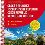
Czech Republic Road Atlas
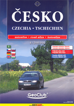
Czech Republic Road Atlas from Shocart in an A4, paperback format with enlargements showing access to 13 main cities, illustrated notes on the country’s UNESCO heritage sites, plus an extensive index.Road and rail networks are shown on a base map with relief shading to present the topography. National parks and other protected areas are marked. Road network includes small local roads and shows locations of fuel suppliers and roadside accommodation, gradient markings, etc. Railways are shown with stations. A range of symbols highlight various facilities and places of interest: hotels, pensions, campsites, UNESCO heritage sites, museums and monuments, etc. The maps have a UTM grid. Map legend includes English. Extensive index shows all localities with their postcodes.Enlargements at 1:50,000 (1:100,000 for Prague) show access routes to and through roads across the country’s 13 main cities. Also included are an overview map of the country with main routes, a distance table, a map and list of border crossings, plus brief multilingual notes (including English) on the country’s UNESCO World Heritage sites.


