Disclosure : This site contains affiliate links to products. We may receive a commission for purchases made through these links.
Czech Republic F&B
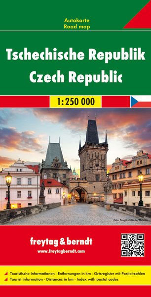
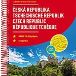
Czech Republic at 1:250,000 on a large double-sided road map from Freytag & Berndt with enlargements showing in greater detail access and main roads across the country’s eight main cities : Prague, Brno, Plzen, Ceskรฉ Budejovice, Karlovy Vary, รstรญ nad Labem, Olomouc and Ostrava. The map divides the country east/west with a small overlap between the sides, with the easternmost part east of Ostrava shown as an inset at the same scale as the main map. Relief shading and spot heights show the country’s topography, with colouring for woodlands and a large number of names of geographical features such as mountain chains. National Parks are shows, as well as restricted entry military areas.Road network includes small local roads, gives driving distances on main and many secondary routes, and shows locations of petrol stations. Railway lines are included and local airports are marked. A range of symbols highlight various places of cultural and historical interest, campsites, sport and recreational facilities, etc. Latitude and longitude lines are marked at intervals of 20’. Extensive index attached to the map cover lists locations with their postcodes. Multilingual map legend includes English.Also provided are eight enlargements at 1:100,000 showing in greater detail road access and main traffic arteries across Prague, Brno, Plzen, Ceskรฉ Budejovice, Karlovy Vary, รstรญ nad Labem, Olomouc and Ostrava.

Related Products:
 Czechia
 Czech Republic F&B Superatlas
 Czech Republic ITMB
 Czech Republic: Breweries Map
 Rick Steves Prague & The Czech Republic (Tenth Edition)
 Rick Steves Prague & The Czech Republic (Eleventh Edition)
 Czech Republic Road Atlas
 Czech Republic 100K Tourist Road Atlas
 Czech Republic Marco Polo Road Atlas
 Czech Republic
 Prague & the Czech Republic National Geoprahic Traveler Guide
 Lonely Planet Prague & the Czech Republic
 Czech Republic NGS Adventure Map 3322
 Prague & Western Czech Republic ITMB
 Czech Republic 100K Cycling Atlas
 Poland/Czech Republic: Hรถfer 200K Road Maps with Historical Place Names
 Czech Republic: MairDumont Marco Polo 200K Road Maps
 Czech – Slovak Republics F&B
 Czech – Slovak Republics F&B Superatlas
 The People`s Republic of China Administrative Map
 Bohemia Marco Polo Map
 Republic of Congo IGN Road Map 85015
 Czech Republic – Culture Smart!
 Congo, Democratic Republic
 Crimea Autonomous Republic
 Malawi Map Studio Adventure Map
 Europe Travellers` Railway Map
 Dominican Republic NGS Adventure Map 3102
 South Western Bohemia
Australia Hema Road & Terrain Map
South Western Bohemia
Australia Hema Road & Terrain Map
 Prague Pocket Atlas
 Central African Republic IGN 85011
 Flag of Czech Republic
 Germany – Benelux – Austria – Switzerland – Czech Republic Michelin Tourist and Motoring Atlas 2021
 Congo Democratic Republic (Carte Generale du Zaire)
 Dominican Republic – Haiti Reise Know-How
 Czech Republic: Kompass 50K Hiking Maps
 Prague Street Atlas
 Montenegro