Disclosure : This site contains affiliate links to products. We may receive a commission for purchases made through these links.
Categories
-
Best Sellers
-
Penguin Great Ideas
-

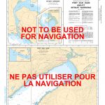
CHS Chart 3647 – Port San Juan and Nitinat Narrows
The official Canadian charts provide an excellent range of scales for the whole length of Canada`s coastline as well as the Grat Lakes and comply with Read More » -

MINDFUL THOUGHTS CYCLISTS
Cycling is about more than competitive racing, lycra, and physical endurance; it`s about joy, meditative wonder and spiritual enrichment.Mindful Thoughts for Cyclists presents a series of Read More » -

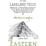
Eastern Fells – Book 1 (Readers Edition)
This is the original Pictorial Guide to the Eastern Fells of Lakeland freshly reproduced from Wainwright`s original pages. The Eastern Fells include the greatest single concentrated Read More » -

Bremerhaven – Cuxhaven Kompass 400
Bremerhaven – Cuxhaven (No. 400), a detailed, GPS compatible map at 1:50,000 from Kompass with local and long-distance footpaths, cycling routes, accommodation, etc, printed on durable, Read More » -

2250 Greenland Eastcoast – Harbour Plans
Official charts for the coast of Greenland produced by the Danish Hydrographic Office. The charts are ordered upon customer demand, therefore please contact us if you Read More » -

NZ22 Kermadec Islands to East Cape
Nautical charts for New Zealand, created by Land Information New Zealand (LINZ), are printed on demand at Stanfords after your order is placed and processed. They Read More » -

Bothwell & Blantyre 1897 – 11.11
Bothwell and Blantyre in 1897 in a fascinating series of reproductions of old Ordnance Survey plans in the Alan Godfrey Editions, ideal for anyone interested in Read More » -

Discover Kayak Fishing
This is the first book on the subject published on this side of the Atlantic, with our different fish species, techniques and approach. The book is Read More » -

Alcala del Valle CNIG Topographic Map 1037-III
Topographic coverage of mainland Spain at 1:25,000 published by the Centro Nacional de Informaciรณn Geograficรก, the country’s civilian survey organization. The maps have contours at 10m Read More »
-


