Disclosure : This site contains affiliate links to products. We may receive a commission for purchases made through these links.
Cuba Reise Know-How
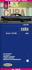
Cuba at 1:650,000 on an indexed road map from Reise Know-How, with a street plan of Havana, printed on light, waterproof and tear-resistant paper and published as part of their highly acclaimed ‘World Mapping Project”. The map is double-sided to provide the best balance between a good scale and a convenient size sheet, and presents the island with a good overlap between the sides.Road and rail networks are clearly visible on the background of light altitude colouring to indicate the island’s topography. The map also shows swamps and mangroves and coral reefs, and has plenty of names of various mountain ranges, peaks, etc. Road network includes local tracks, shows locations of petrol stations and gives driving distances on main and secondary routes. Symbols highlight various places of interest including campsites, beaches, diving and fishing sites, national parks and nature reserves, etc. Also marked are internal administrative boundaries with names of the provinces. The map is indexed and has latitude and longitude lines at intervals of 1ยฐ. Map legend includes English.A large panel shows Havana, indicating principal traffic arteries and important buildings, with another inset covering the city’s international airport.

Related Products:
 Cuba Michelin
 Cuba NGS Adventure Map 3112
 Cuba Borch
 Cuba Gizi Map
 Cuba Wall Map
 Cuba ITMB
 New Zealand Reise Know-How
 Sri Lanka Reise Know-How
 New Zealand – North Island Reise Know-How
 New Zealand – South Island Reise Know-How
 Cuba West ITMB
 Mauritius – Reunion – Rodrigues Reise Know-How
 Philippines Reise Know-How
 Cyprus Reise Know-How
 Bali – Lombok – Komodo Reise Know-How
 Cuba terraQuest Adventure Map
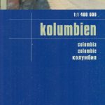 Colombia Reise Know-How
 Tunisia Reise Know-How
 Corsica Reise Know-How
 Ireland Reise Know-How
 South Africa Reise Know-How
 Indochina: Vietnam – Laos – Cambodia Reise Know-How
 Cuba Nelles
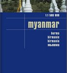 Myanmar / Burma Reise Know-How
 Libya Reise Know-How
 Costa Rica Reise Know-How
 Ecuador – Galapagos Islands Reise Know-How
 Costa Rica – Panama Reise Know-How
 Caucasus Reise Know-How
 Madagascar Reise Know-How
 Cambodia Reise Know-How
 Algarve Reise Know-How
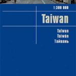 Taiwan Reise Know-How
 Crete Reise Know-How
 Western Balkans Reise Know-How
 Ethiopia – Somalia – Eritrea – Djibouti Reise-Know-How
 Morocco Reise Know-How
 Yucatan Reise Know-How
 Thailand Reise Know-How