Disclosure : This site contains affiliate links to products. We may receive a commission for purchases made through these links.
Cuba Nelles
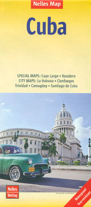
Cuba at 1:775,000 from Nelles Verlag, now published on a handy size, light, waterproof and tear-resistant map. The map includes street plans of central Havana with an enlargement of the Old Town area, plus plans of four other cities and an enlargement for the Varadero Peninsula The map divides the island east/west, with relief shading, spot heights and names of mountain ranges presenting the topography. National parks and other protected area are marked. Road network distinguishes between partially paved roads and cart tracks, and shows distances on main and many secondary routes. Railway lines and local airports are included, and the map also shows internal administrative boundaries with names of the provinces. Numerous places of interest are prominently marked. Latitude and longitude margin ticks are at 30’ intervals. The map has no index of localities. Map legend includes English.The map also provides insets with street plans of central Havana plus a more detailed enlargement of the city’s Old Town ‘“ La Habana Vieja, plans of city centres in Trinidad, Cienfuegos, Camagรผey and Santiago de Cuba, plus the Varadero Peninsula. All are annotated with places of interest and various facilities.


