Disclosure : This site contains affiliate links to products. We may receive a commission for purchases made through these links.
Categories
-
Best Sellers
-

In Line to the Throne: Prince Charles and the Other 29 in Waiting
We all know who`s next in line to the throne. Or do we? Well, yes, of course we do. It goes Charles, William, George, Charlotte, and Read More » -

The Constellations Wall Map PAPER
This functional map shows every star directly observable by the naked eye indicated by magnitude and brightness. Also mapped are the nebulae, star clusters and galaxies Read More » -

Eastbourne and Hastings 1898
Map No. 199, Eastbourne and Hastings 1898, in the Cassini Historical Series of old Ordnance Survey mapping of England and Wales at 1:50,000 in a format Read More » -
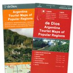
North Argentina de Dios Regional Map
North-western Argentina on a handy size, waterproof and tear-resistant concertina map from the Buenos Aires-based De Dios providing an overview road map of the region, five Read More » -

Goole & Gilberdyke – Holme-on-Spalding-Moor, Hemingbrough & Howden OS Explorer Map 291 (paper)
Goole, Gilberdyke, Holme-on-Spalding-Moor, Hemingbrough and Howden area on a detailed topographic and GPS compatible map No. 291, paper version, from the Ordnance Survey’s 1:25,000 Explorer series. Read More » -
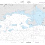
NGA Chart 26206 – Aquin
Produced by the US Government, National Geospatial-Intelligence Agency (NGA) charts provide information for the International Waters. They are printed on demand at our London shop and Read More » -

The Art of Language
Discover and practice over 26 scripts.From Arabic and Japanese to Hebrew, Javanese and Cherokee, explore 26 unique scripts and alphabets with Lonely Planet – and learn Read More » -

Five Little Pumpkins
Roll into Halloween with this wickedly funny rhyming book!Five little pumpkins sitting on a gate.The first one said, “My, it`s getting late!”The second one said, “There Read More » -

Pottmes L09
Pottmes in a series of GPS compatible recreational editions of the Bavarian topographic survey at 1:25,000, with waymarked hiking trails and cycling routes, campsites and youth Read More » -

River of Gold: Narratives and Exploration of the Great Limpopo
-


