Disclosure : This site contains affiliate links to products. We may receive a commission for purchases made through these links.
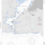
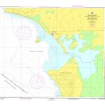
CUBA CK2 – Cabo Corrientes Bahia de Casilda
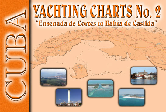
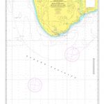
The Cuban Yachting Charts, commonly referred to as Cuban Chart Kits, consists of a series of 8 chart-books that cover virtually the entire Cuban coast. Each chart-book contains 6 to 12 detailed colour charts, which are accurate for use with GPS. The scale of the charts range from 1: 500,000 to 1: 5,000 for selected harbours. Not every harbor is covered, but the most desirable harbours for yachtsmen are included. Each chart displays the depths in meters and the charts include information in both English and Spanish in this chart kit!Cuba CK2 – Ensenada De Cortes To Bahia De Casilda is part 2 of the series. Good graphical representations of the topography when sailing Cuban waters is essential. Each chart is characterized by fine contours and easy to distinguish colour graduations of the depth lines. Presented in a handy, user friendly size, enabling the chartkit to be easily accessed or stored. Ensure your adventures to this stunning region is a success with the guide of the Cuban Yachting Charts!In addition to the 8 Yachting Chart Folios (chart books) covering all of the coastline of Cuba by geographic areas, a range of individual Official Cuban Hydrographic Office charts is available to order on demand. Minimum order quantity is 15 charts. Approximately 170 standard navigation charts can be sourced through Stanfords, which come imported from Havana and are corrected by hand to their latest monthly notice to Mariners. For more information and a quote, please email maritime@stanfords.co.uk

Related Products:
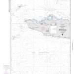
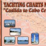 CUBA CK3 – Bahia de Casilda to Cabo Cruz
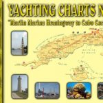 CUBA CK1 – Marlin Marina Hemingway to Cabo Corrientes
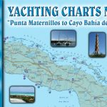 CUBA CK6 – Punta Maternillos to Bahia de Cadiz
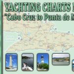 CUBA CK4 – Cabo Cruz to Punta Maisi
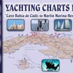 CUBA CK7 – Cayo Bahia de Cadiz to Marlin Marina Hemingway
 CUBA CK8 – Sailing in Cuban Waters
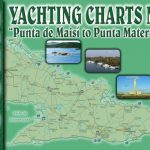 CUBA CK5 – Punta Maisi to Punta Maternillos
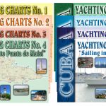 Cuban Yachting Chart Folios
 SEMAR Chart 352 – Banco Golden Gate to Bahia San Jose del Cabo, Baja California Sur
 SEMAR Chart 622.3 – Bahia San Augustin to Bahia Maguey
SEMAR Chart 622.4 – Bahia Maguey to Bahia Conejos
SEMAR Chart 622.3 – Bahia San Augustin to Bahia Maguey
SEMAR Chart 622.4 – Bahia Maguey to Bahia Conejos
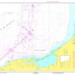
 NGA Chart 26224 – Bahia de Santiago de Cuba
 Admiralty Chart 4207 – Falkland Islands to Cabo Corrientes and South Georgia Rise
 NGA Chart 26220 – Cabo Cruz to Santiago de Cuba
 SEMAR Chart 300B – Cabo San Lazaro to Cabo San Lucas, including south of California Gulf
 SEMAR Chart 840 – Bahia de Campeche
 SEMAR Chart 221.3 – Bahia de los Angeles
SEMAR Chart 361.1 – Bahia del Altata
SEMAR Chart 221.3 – Bahia de los Angeles
SEMAR Chart 361.1 – Bahia del Altata
 SEMAR Chart 521.4 – Bahia de Zihuatanejo
SEMAR Chart 612.3 – Bahia de Chacahua
SEMAR Chart 521.4 – Bahia de Zihuatanejo
SEMAR Chart 612.3 – Bahia de Chacahua
 SEMAR Chart 223.5 – Bahia Kino, Sonora
SEMAR Chart 423.2 – Bahia Tenacatita, Jalisco
SEMAR Chart 423.4 – Bahia Chamela, Jalisco
SEMAR Chart 521.3 – Bahia de Isla Grande
SEMAR Chart 223.5 – Bahia Kino, Sonora
SEMAR Chart 423.2 – Bahia Tenacatita, Jalisco
SEMAR Chart 423.4 – Bahia Chamela, Jalisco
SEMAR Chart 521.3 – Bahia de Isla Grande
 SEMAR Chart 221.4 – Ensenada la Gringa (Bahia de los Angeles)
SEMAR Chart 030 – Rio Bravo to Bahia de Chetumal
SEMAR Chart 221.4 – Ensenada la Gringa (Bahia de los Angeles)
SEMAR Chart 030 – Rio Bravo to Bahia de Chetumal
 SEMAR Chart 110 – San Diego to Cabo Colnett
SEMAR Chart 511 – Bahia de Navidad to Boca de Apiza
SEMAR Chart 233.5 – Bahia Guasimas, Sonora and Approaches
SEMAR Chart 362.2 – Bahia la Guadalupana and Isla Quevedo
SEMAR Chart 110 – San Diego to Cabo Colnett
SEMAR Chart 511 – Bahia de Navidad to Boca de Apiza
SEMAR Chart 233.5 – Bahia Guasimas, Sonora and Approaches
SEMAR Chart 362.2 – Bahia la Guadalupana and Isla Quevedo
 Cuba In Revolution
SEMAR Chart 811.2 – Cabo Rojo, Veracruz
Cuba In Revolution
SEMAR Chart 811.2 – Cabo Rojo, Veracruz
 SEMAR Chart 323.2 – Bahia Pichilingue
SEMAR Chart 403.1 – Bahia Vargas Lozano (Isla Socorro)
SEMAR Chart 323.2 – Bahia Pichilingue
SEMAR Chart 403.1 – Bahia Vargas Lozano (Isla Socorro)
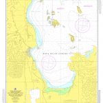
 SEMAR Chart 922.2 – Bahia Isla Mujeres, Quintana Roo
 SHOM Chart 7474 – De Cuba ร Puerto Rico
 DK Eyewitness Travel Guide Cuba