Disclosure : This site contains affiliate links to products. We may receive a commission for purchases made through these links.
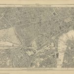
Crystal Palace 1871 – 7.10
Crystal Palace in 1871 in a fascinating series of reproductions of old Ordnance Survey plans in the Alan Godfrey Editions, ideal for anyone interested in the history of their neighbourhood or family. Two versions have been published to show how the area developed across the years – the two maps are from different series, for Kent and for London, and so the sheetlines are somewhat different. The Kent series map No. 7.10 is kinder to the Crystal Palace itself; the map even shows the interior layout and the grounds in all their glory. The map stretches from Gipsy Hill station eastward to Penge station on the LCD line, from Crystal Palace station northward to Upper Sydenham and Wells Road. A more detailed plan of the Palace, from the Illustrated London News, is on the reverse. The sheetlines for the London Sheet 145 are slightly different and are really centred on Anerley Hill. This map just covers part of the Crystal Palace at the top of the map, plus an area southward to South Norwood Lake, from Beulah Hill eastward to Maple Road and Penge Recreation Ground. Features include Crystal Palace (Low Level) station, Penge and Anerley stations on the Brighton line, Queen`s Hotel, Central Hill, Westow Hill, the western part of Penge, North Surrey District Schools, and much of Anerley. On the reverse are street directories for Auckland Road, Churcfh Road, Westow Hill and Westow Street. About the Alan Godfrey Editions of the 25″ OS Series:Selected towns in Great Britain and Ireland are covered by maps showing the extent of urban development in the last decades of the 19th and early 20th century. The plans have been taken from the Ordnance Survey mapping and reprinted at about 15 inches to one mile (1:4,340). On the reverse most maps have historical notes and many also include extracts from contemporary directories. Most maps cover about one mile (1.6kms) north/south, one and a half miles (2.4kms) across; adjoining sheets can be combined to provide wider coverage.FOR MORE INFORMATION AND A COMPLETE LIST OF ALL AVAILABLE TITLES PLEASE CLICK ON THE SERIES LINK.

Related Products:
 Crystal Palace, Anerley and Upper Norwood 1894 – 145
 Peckham 1871 – 103.1
 Kennington & Walworth 1871 – 89.1
Notting Hill 1871 – 59.1
Kennington & Walworth 1871 – 89.1
Notting Hill 1871 – 59.1
 Kensington 1871 – 74.1
 The Crystal Palace
 Highbury & Islington 1871 – 39.1
 Clerkenwell, King`s Cross & The Angel 1871 – 50.1
Hammersmith & Fulham 1871 – 86.1
Clerkenwell, King`s Cross & The Angel 1871 – 50.1
Hammersmith & Fulham 1871 – 86.1
 North Shields & Chirton 1894
 Great Exhibitions: From the Crystal Palace to the Dome
 Upper Sydenham 1894 – 137.2
 Holland Park & Shepherds Bush 1871 – 73.1
 South Croydon 1895 – 14.14
 South Croydon 1895 – 159.2
Central Croydon 1895 – 14.10
South Croydon 1895 – 159.2
Central Croydon 1895 – 14.10
 Norwich (South) 1905 – 63.15
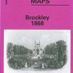 Brockley 1868 – 118.1
Norwich (North) 1905 – 63.11
Thornton Heath and Norbury 1894
Brockley 1868 – 118.1
Norwich (North) 1905 – 63.11
Thornton Heath and Norbury 1894
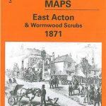 East Acton & Wormwood Scrubs 1871 – 58.1
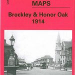 Brockley & Honor Oak 1914 – 118.3
Luton 1922 – 33.05
March Station 1900
Brockley & Honor Oak 1914 – 118.3
Luton 1922 – 33.05
March Station 1900
 Beckenham South 1894
New Cross & Deptford Bridge 1871 – 104.1
Beckenham & Penge 1894 – 146
Beckenham South 1894
New Cross & Deptford Bridge 1871 – 104.1
Beckenham & Penge 1894 – 146
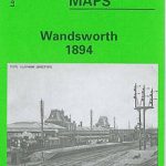 Wandsworth 1894 – 114a
Streatham Hill & Tulse Hill 1914 – 126.3
Wandsworth 1894 – 114a
Streatham Hill & Tulse Hill 1914 – 126.3
 Streatham Hill & Tulse Hill 1894 – 126.2
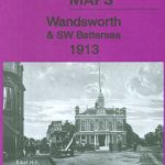 Wandsworth & SW Battersea 1913 – 114b
 Lewisham 1914 – 119.3
 Glasgow High Street 1909
Glasgow High Street 1933
Glasgow High Street 1909
Glasgow High Street 1933
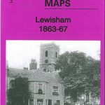 Lewisham 1863-67 – 119.1
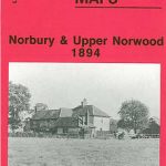 Norbury and Upper Norwood 1894
Hamilton 1896
Guildford 1895
Norbury and Upper Norwood 1894
Hamilton 1896
Guildford 1895
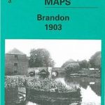 Brandon 1903
 Derby (South) 1899 – 50.13a