Disclosure : This site contains affiliate links to products. We may receive a commission for purchases made through these links.
Categories
-
Best Sellers
-

The English Lakes – North-Western Area – Keswick, Cockermouth & Wigton OS Explorer OL4 ACTIVE
OS Explorer is the Ordnance Survey`s most detailed map and is recommended for anyone enjoying outdoor activities such as walking, horse riding and off-road cycling. The Read More » -

Ten Poems about Bicycles
-

Reluctant Meister: Germany and the New Europe
The Euro crisis has served as a stark reminder of the fundamental importance of Germany to the larger European project. But the image of Germany as Read More » -

St Eustatius / Statia
The Dutch island of St Eustatius, also affectionately known by the locals as Statia or Statius, on a detailed map at 1:10,000 from the Caribbean-based cartographer Read More » -

Waking Up: Searching for Spirituality Without Religion
For the millions of people who want spirituality without religion, Sam Harris` new book is a guide to meditation as a rational spiritual practice informed by Read More » -

Hummingbird Bakery Notecards With Recipes (Tin)
Contains 20 cards and envelopes. Suitable for bakers, each card features a recipe from “The Hummingbird Bakery Cookbook.” Read More » -

NZ5214 Marsden Point
Nautical charts for New Zealand, created by Land Information New Zealand (LINZ), are printed on demand at Stanfords after your order is placed and processed. They Read More » -

IMO/UNEP Guidance Manual on Assesment and Restauration – E-Book
Please allow 1-2 working days for the license to be issued by email. The objective of the Manual is to provide guidance on strategies that may Read More » -
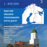
Karelia Karttakeskus Road Map
Double-sided, detailed road map at 1:800,000 of the Karelian Republic and the Murmansk Oblast with street plans of nine main cities, published by Finland’s national survey Read More » -
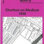
Manchester: Chorlton-on-Medlock 1848
Chorlton-on-Medlock area of Manchester in 1848 in a series of exceptionally detailed reproductions of old Ordnance Survey street plans for areas of larger cities which have Read More »
-


