Disclosure : This site contains affiliate links to products. We may receive a commission for purchases made through these links.
Croatian Coast K+F Road Map
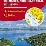
Croatian coast on an indexed road map with small plans of central Pula, Rijeka, Zadar, Split and Dubrovnik from the Swiss cartographic group Hallwag Kรผmmerly + Frey.Coverage, presented in two panels, extends from Trieste and Ljubljana to the border with Montenegro. The base map has subtle relief shading, names of mountain ranges in the hinterland and spot heights. Boundaries of national parks and other protected areas are indicated. Road network includes selected country tracks and gives locations of petrol stations and driving distances on main routes. Railway lines are shown with stations. Ferry routes and marinas or anchorage are marked. Places of interest, including campsites, viewpoints, archaeological sites, churches and monasteries, etc., are highlighted. The map has latitude and longitude grid at intervals of 15’. The index is in a separate booklet attached to the map cover. Map legend includes English. Also included are plans of central Pula, Rijeka, Zadar and Split, plus the historic centre of Dubrovnik, annotated with places of interest.

Related Products:
 Croatian Coast Flash Map-Guide
 Dalmatian Coast F&B Top 10 Tips
 Croatia – Slovenia F&B Road Atlas
 Dubrovnik & Croatian Coast Cruise ITMB Street Plan and Regional Map
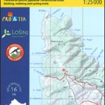
 Dalmatian Coast North – Krk ‘“ Cres ‘“ Loลกinj ‘“ Rab ‘“ Pag – Zadar Kompass 2901
Croatia & Montenegro – Adriatic Coast ExpressMap
Dalmatian Coast North – Krk ‘“ Cres ‘“ Loลกinj ‘“ Rab ‘“ Pag – Zadar Kompass 2901
Croatia & Montenegro – Adriatic Coast ExpressMap
 Croatia: Freytag & Berndt Maps of the Croatian Coast
 Croatia F&B
 Dalmatia – Croatia Coast Central and South
 Kameลกnica Mountain Croatian Mountain Rescue Service 25K Map
 Paklenica National Park Croatian Mountain Rescue Service 25K Map
 Croatia – Slovenia Marco Polo Map
 Dalmatian Coast 1 – Zadar – Kornati Islands F&B
 Stockholm County Norstedts Road Map
 Carinthia – Northern Adriatic Coast F&B
 Croatia – Montenegro Coast Cartographia 2-Map Set
Croatia: Kompass 100K Maps of the Dalmatian Coast
Croatia – Montenegro Coast Cartographia 2-Map Set
Croatia: Kompass 100K Maps of the Dalmatian Coast
 Croatia – Dalmatian Coast 3-Map Set Kompass 2900
 Coast Around Lisbon Turinta
 DK Eyewitness Top 10 Dubrovnik and the Dalmatian Coast
 Dalmatian Coast 2 – Sibenik – Split – Vis F&B
 Slovenia & Croatian Coast ITMB
 Lithuania Jana Seta Compact Road Atlas
 Middle Dalmatian Coast 4 – Mljet – Medugorje – Dubrovnik F&B
 Croatian-English, English-Croatian Dictionary and Phrasebook
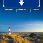 North Sea Coast – Bremen – Hamburg K+F Regional Road Map
 Lithuania Jana Seta Road Atlas HARDBACK
 Estonia Jana Seta Road Map
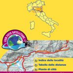 Italy: Michelin 200K Regional Road Maps
 Dugi, Iลพ & Sestrunj Islands Croatian Mountain Rescue Service 25K Map
 Loลกinj Island Croatian Mountain Rescue Service 25K Map
Denmark Road Atlas
Loลกinj Island Croatian Mountain Rescue Service 25K Map
Denmark Road Atlas
 Cuba ITMB
 Spain: Michelin Regional Road Maps
 Istria: Cicarija Plateau Croatian Mountain Rescue Service 25K Map
 Bulgaria Cartographia Road Map
 Finland Road Atlas GLOVEBOX, SPIRAL-BOUND
 Sweden F&B Road Atlas
 Crimea Road Atlas
 Central Europe F&B Compact Road Atlas