Disclosure : This site contains affiliate links to products. We may receive a commission for purchases made through these links.
Croatia – Montenegro Coast Cartographia 2-Map Set
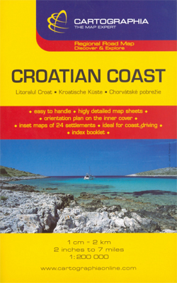
The Adriatic Coast of Croatia and Montenegro, from Trieste and Istria to the Albanian border at 1:160,000 on a set of two separate maps with numerous street plans of central areas in its towns and holiday resorts, plus a separate booklet.The whole coastline is presented on two double-sided maps with, where appropriate, some of the outlying islands shown as insets. The southernmost part is shown on two panels, covering separately the coastlines of Croatia and Montenegro.Clear presentation of the region’s road network includes selected local roads and cart tracks. Driving distances are shown on main and some secondary routes and locations of petrol stations are marked. The map indicates ferry connections to the island and on the mainland railway lines are shown (although not identified in the legend). A range of symbols mark various places of interest. The maps have latitude and longitude lines at intervals of 10’. The index is in a separate booklet. Map legend includes English.The maps includes 23 insets with street plans of central areas in the region’s towns and holiday resorts, annotated with places of interest and main facilities. Disapprovingly, but inevitably given the region’s geography, not all the street plans appear on the same side of the map as the town itself.*Please note: the map cover indicates a scale of 1:200,000, but the maps themselves show 1:160,000 both as a ratio and as a linear representation of the scale.*

Related Products:
 Croatia/Montenegro: MairDumont Marco Polo 200K Road Maps of the Dalmatian Coast
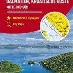 Dalmatia – Croatia Coast Central and South
 Croatia F&B
 Bulgarian and Romanian Coast
 Arad – Timisoara Cartographia Street Plan
 Brasov – Targu Mures Cartographia Street Plan
 Montenegro F&B
 Baltic Coast: Gdynia – Hel Peninsula – Nadmorski Regional Park
 Slovenia – Croatia – Serbia – Bosnia-Herzegovina – Macedonia – Kosovo – Montenegro F&B
 Coast Around Lisbon Turinta
 Croatia & Montenegro – Adriatic Coast ExpressMap
 Croatia: Freytag & Berndt Maps of the Croatian Coast
 Bulgarian and Romanian Black Sea Coast F&B Top 10 Tips
 Croatia – Slovenia Marco Polo Map
 Transylvania F&B
 Cluj Napoca – Oradea Cartographia Street Plan
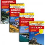 Spanish Atlantic Coast – Galicia – Asturias – Cantabria
 Croatia – Slovenia F&B Road Atlas
 Croatia – Dalmatian Coast 3-Map Set Kompass 2900
 Sumatra – Medan Periplus Travel Map
 Bulgaria Cartographia Road Map
 Dalmatian Coast F&B Top 10 Tips
 Albena, Kranevo and Balchik
 Serbia/Montenegro: Geokarta Hiking and Recreational Maps
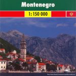
Montenegro Coast
Croatia: Kompass 100K Maps of the Dalmatian Coast
Serbia/Montenegro: Geokarta Hiking and Recreational Maps
Montenegro Coast
Croatia: Kompass 100K Maps of the Dalmatian Coast
 Black Forest F&B Top 10 Tips
 Patagonia
 Aruba Borch
 Washington and Oregon Coast
 Cuba Marco Polo Map
 Iasi Cartographia Street Plan
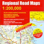
Spain: Mairdumont 300K Regional Road Maps
Iasi Cartographia Street Plan
Spain: Mairdumont 300K Regional Road Maps
 Sorrento Peninsula – Amalfi Coast – Capri Global Map Tourist Map
 Germany: Freytag & Berndt “Top 10 Tips” Road Maps
 Debrecen
 Tatra F&B Top 10 Tips
 Latgale South Jana Seta Tourist Map
 Dunedin, Mosgiel, Oamaru and Otago Towns Pocket Map
 Corsica F&B Top 10 Tips