Disclosure : This site contains affiliate links to products. We may receive a commission for purchases made through these links.
Coventry (North) 1912 – 21.08
North Coventry in 1912 in a fascinating series of reproductions of old Ordnance Survey plans in the Alan Godfrey Editions, ideal for anyone interested in the history of their neighbourhood or family. Coventry in covered on four maps:COVENTRY CENTRAL 1905 map covers the city centre, extending from Queen Victoria Road eastward to Gosford Green and Stoke Knob, and from the station (bottom left corner) northward to Drapers Field and Sackville Street. Features include St Michael`s church, Cattle Market, Maudslay Motor Works, Velox Motor Works, Kitson Works, Cheylesmore Works, Meteor motor cycle works, Triumph cycle works, Challenge Cycle Works, Singer cycle works, Premier cycle works, Coronet motor works, Sparkbrook cycle works, Dunlop works and many more factories for cycles, motors or related trades. Street directory entries for Broadgate, Butcher Row, Cross Cheaping, Greyfriars Lane and High Street are also provided. This title, COVENTRY NORTH 1912 map, covers an area around Foleshill Road and Stoney Stanton Road, stretching from Harnall Lane East northward to Great Heath, Paradise and Highfield Street, and from Sandy Lane eastward to Stoke Heath and Barras Heath. Features include the Coventry Canal, tramways and tram depot, mineral railway leading to an ordnance factory, Bishopsgate Green, King Field ribbon works, Swanswell Ward, Harnall Ward, Courtauld`s Artificial Silk factory, Daimler`s Motor Mill, etc. On the reverse is a section of the 1921 Directory, A to G. COVENTRY WEST 1094-1911 map is taken from the unusual Inland Revenue; these were maps partially revised to 1911 to chart the progress of the area between 1904 and 1911. Spon End is in the centre, with coverage stretching from Spon Street and St Osburg`s Priory westward to Chapel Fields, Hearsall Common and, at the western edge of the map, Whoberley Hall. Features include Coundon Road station, Rudge Motor & Cycle Works, St Thomas`s church. The directory continues on this map with entries H to P, plus a timetable for the Coventry-Nuneaton railway in 1897. COVENTRY SOUTH 1912 map continues coverage south and is far less built up. The railways include the Leamington branch. Features include Whitley Common, Whitley Coal Wharf, engine shed (at Leamington Jct), St James church Stivichall. Directory entries P to Z are also included, plus a directory for the tiny village (population 81) of Stivichall. About the Alan Godfrey Editions of the 25″ OS Series:Selected towns in Great Britain and Ireland are covered by maps showing the extent of urban development in the last decades of the 19th and early 20th century. The plans have been taken from the Ordnance Survey mapping and reprinted at about 15 inches to one mile (1:4,340). On the reverse most maps have historical notes and many also include extracts from contemporary directories. Most maps cover about one mile (1.6kms) north/south, one and a half miles (2.4kms) across; adjoining sheets can be combined to provide wider coverage.FOR MORE INFORMATION AND A COMPLETE LIST OF ALL AVAILABLE TITLES PLEASE CLICK ON THE SERIES LINK.

Related Products:
 Coventry (South) 1912 – 21.16
Coventry (West) 1904-11 – 21.11
Coventry (South) 1912 – 21.16
Coventry (West) 1904-11 – 21.11
 Coventry 1905 – 21.12b
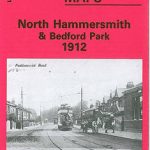 North Hammersmith and Bedford Park 1912
 Jarrow 1912
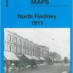 North Finchley 1911
Leeds Central and North East 1890
Surbiton & Long Ditton 1912 – 12.08
Wood Green 1912 – 7.3
North Finchley 1911
Leeds Central and North East 1890
Surbiton & Long Ditton 1912 – 12.08
Wood Green 1912 – 7.3
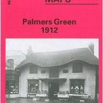 Palmers Green 1912 – 7.14a
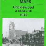 Cricklewood and Child`s Hill 1912
Norwich (North) 1905 – 63.11
Leicester North West 1902
North Finchley 1894
St Anthonys and Bill Quay 1912
Birmingham North 1913
Cricklewood and Child`s Hill 1912
Norwich (North) 1905 – 63.11
Leicester North West 1902
North Finchley 1894
St Anthonys and Bill Quay 1912
Birmingham North 1913
 Alexandra Park & South Friern 1911 – 6b
Newton Heath 1915
Alexandra Park & South Friern 1911 – 6b
Newton Heath 1915
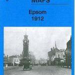 Epsom 1912
Stockton (North) 1899 – 50.12a
North Shields and Chirton 1894
Doncaster North 1929
Epsom 1912
Stockton (North) 1899 – 50.12a
North Shields and Chirton 1894
Doncaster North 1929
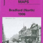 Bradford North 1906
Manchester North West and Central Salford 1915
Bradford North 1906
Manchester North West and Central Salford 1915
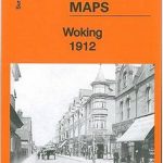 Woking 1912 – 17.09
 Brixton & Herne Hill 1894 – 116.2
Willenhall North East 1885
Brixton & Herne Hill 1913 – 116.3
Brixton & Herne Hill 1894 – 116.2
Willenhall North East 1885
Brixton & Herne Hill 1913 – 116.3
 Croydon 1895 – 157
 Brixton & Herne Hill 1870 – 116.1
 Bromley North and Sundridge Park 1895
 North Hammersmith 1869 – 72.1
 Cambridge (North) 1901 – 40.14
Nottingham North 1913
Cambridge (North) 1901 – 40.14
Nottingham North 1913
 North Hammersmith & Bedford Park 1893 – 72.2
 Gospel Oak 1912 – 28.2
 Pendleton North 1915
Anfield 1908 – 106.07b
Middlesbrough North 1913
Worcester North-East 1902
Pendleton North 1915
Anfield 1908 – 106.07b
Middlesbrough North 1913
Worcester North-East 1902