Disclosure : This site contains affiliate links to products. We may receive a commission for purchases made through these links.
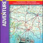
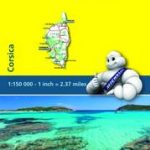
Corsica Adventure Map
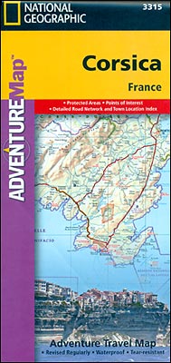
Corsica at 1:150,000 approx. on a map from the National Geographic Society printed on light, waterproof and tear-resistant synthetic paper. The map is double-sided with a very generous overlap between the two sides.The map is an adaptation of cartography prepared by the German publishers Reise Know-How and published in Britain under the Rough Guides imprint. The original altitude colouring has been replaced here by bolder relief shading, with contours interval adjusted to 200m. Boundaries of the Parc Naturel Rรฉgional de Corse are clearly marked, as are those of other protected areas.Road network includes selected local county tracks. Driving distances are marked on main routes and scenic roads are highlighted. The map also shows the course of the island’s famous GR 20 long-distance hiking path. Symbols indicate various places of interest, including locations of campsites and mountain huts. The map is indexed and has latitude and latitude lines at intervals of 5’.PLEASE NOTE: to ensure regular supplies and faster delivery to our customers we keep as regular stock the original Reise Know-How edition in the Rough Guides imprint whilst the NGS version can be ordered on request.

Related Products:
 Corsica Reise Know-How
 Corsica F&B Top 10 Tips
 Tuscany Adventure Map
 Sicily NGS Adventure Map 3310
 Peru NGS Adventure Map 3404
 South Africa Adventure Map
 Corsica South 3-Map Set Kompass 2251
 Corsica North 3-Map Set Kompass 2250
 Slovenia Adventure Map
 Thailand Adventure Map
 Corsica Marco Polo Map
 Corsica Walking
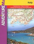
 Italy NGS Adventure Map 3304
 Granite Island – A Portrait of Corsica
 Ecuador – Galapagos NGS Adventure Map 3403
 Vietnam North NGS Adventure Map 3015
 Vietnam South NGS Adventure Map 3016
 Sardinia NGS Adventure Map 3309
 Northern Spain NGS Adventure Map 3306
 Australia Adventure Map
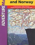 Southern Sweden and Norway Adventure Map
 Finland and Northern Scandinavia NGS Adventure Map 3300
 Corsica North Didier Richard 08
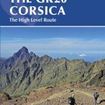 The GR20 Corsica: The High Level Route
 Corsica South Didier Richard 09
 Brazil NGS Adventure Map 3401
 DK Eyewitness Top 10 Corsica
 Chile NGS Adventure Map 3402
 Morocco NGS Adventure Map 3203
 Nicaragua – Honduras – El Salvador NGS Adventure Map 3109
 India South Adventure Map
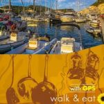 Corsica – Walk & Eat
 Australia East Adventure Map
 India Northeast NGS Adventure Map 3012
 Corsica & North Sardinia Pilot
 Corsica Michelin Local 345
 New Zealand Adventure Map
 Mexico NGS Adventure Map 3108
 Egypt NGS Adventure Map 3202
 India Adventure Map