Disclosure : This site contains affiliate links to products. We may receive a commission for purchases made through these links.
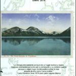
Cordillera Blanca North Alpenverein 0/3A
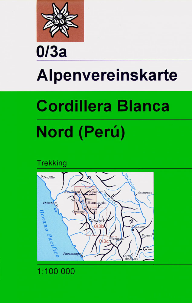
Cordillera Blanca North, one of three excellent maps of the Cordillera Blanca and Huayhuash, highlighting local hiking trails. The maps, produced by the Austrian Alpine Club and updated in mid-2000s, provide a very clear picture of the topography with contours at 50m intervals (25m in Cordillera Huayhuash), spot heights, relief shading, graphics to indicate rocks, scree and moraine and colouring for cultivated areas. Road network includes dirt tracks and footpaths. Trekking routes and camp sites are highlighted. The maps have a UTM grid and latitude/longitude margin ticks at 5’ intervals. Map legend includes English.

Related Products:
 Cordillera Blanca South Alpenverein 0/3B
 Cordillera Huayhuash Alpenverein 0/3C
Peru: Alpenvereinskarte Trekking Maps
Cordillera Huayhuash Alpenverein 0/3C
Peru: Alpenvereinskarte Trekking Maps
 Huaraz, Peru – Cordillera Blanca & Huayhuash Tourist Map
 Cordillera Real North – Illampu Alpenverein 0/8
Cordillera Real South – Illimani Alpenverein 0/9
Bolivia: Alpenvereinskarte Walking Maps of Cordillera Real
Cordillera Real North – Illampu Alpenverein 0/8
Cordillera Real South – Illimani Alpenverein 0/9
Bolivia: Alpenvereinskarte Walking Maps of Cordillera Real
 Peru`s Cordilleras Blanca & Huayhuash – The Hiking & Biking Guide
 Cordillera Cantabrica
 Playa Blanca CNIG Topo 1084-1/2
 Playa Blanca CNIG Topo 1084
 Alqueria Blanca 25K Mallorca CNIG Topographic Survey Map No. 725-III
 Cordillera Cantabrica – Asturias and the Surrounding Provinces Adrados Map
 Rio Verde – Laguna Blanca SIG Patagon
 Costa Blanca Mountains Super-Durable Map
 Lima & Central Peru ITMB
 North Costa Blanca Road Cycle Map
 Costa Blanca Michelin Zoom 123
 Tierra del Fuego – Cordillera Darwin – Lago Fagnano – Isla Navarino SIG Patagon
 Peru: 100K Topographic Survey Maps
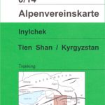 Inylchek – Tien Shan Alpenverein 0/14
 Koh-e Pamir Alpenverein 0/6
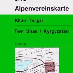 Khan Tengri – Tien Shan Alpenverein 0/15
 Poland: Carta Blanca/Kompas Road Atlas 2015 GLOVEBOX, SPIRAL-BOUND
 Costa Blanca – Valencia – Alicante – Castellon – Murcia Marco Polo Map
 Koh-e Keshnikhan Alpenverein 0/5
 North Wind River Range
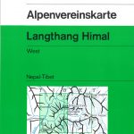 Langthang Himal West Alpenverein 0/10
 Langthang Himal East Alpenverein 0/11
 DK Eyewitness Top 10 Costa Blanca
 Roca Espana: Costa Blanca Sud
 Peru – Ecuador Nelles
 Borjomi George – Bakuriani Geoland 12
 Ushguli – Lashkheti – Mt.Shkhara Geoland 8
 Oni – Utsera Resort – Ghebi Resort Geoland 7
 Costa Blanca RockFax
 Cordillera Cantabrica Walking
 Shatili – Mutso – Mt. Didi Borbalo Geoland 2
 WATERPROOF
Shatili – Mutso – Mt. Didi Borbalo Geoland 2
Shatili – Mutso – Mt. Didi Borbalo Geoland 2 WATERPROOF
 Mt Ushba – Mestia Geoland 10