Disclosure : This site contains affiliate links to products. We may receive a commission for purchases made through these links.
Categories
-
Best Sellers
-

Stanford`s Map of Italy (1859) – A1 Wall Map, Canvas
The Stanford’s Map of Italy is from a fascinating series of reproductions from our Edward Stanford Cartographic Collection archive.This is a reproduction of a map originally Read More » -

The Dictionary of Difficult Words: With more than 400 perplexing words to test your wits!
What is a bumbershoot? Or a moonbow? And what does it mean when someone absquatulates…? Find out all this and more in the Dictionary of Difficult Read More » -

Arkansas River – Leadville to Salida
: Waterproof ‘: Tear-Resistant ‘: Fishing & River MapThe Arkansas River, Leadville to Salida Fishing & River Map Guide is designed to be the perfect companion Read More » -
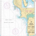
CHS Chart 4682 – Larkin Point to Cape Anguille
The official Canadian charts provide an excellent range of scales for the whole length of Canada`s coastline as well as the Grat Lakes and comply with Read More » -

A Christmas Carol and Other Christmas Writings
Part of “Penguin`s” beautiful hardback “Clothbound Classics” series, designed by the award-winning Coralie Bickford-Smith, these delectable and collectible editions are bound in high-quality colourful, tactile cloth Read More » -

Ceuta CNIG Topo 1110-3
Ceuta, one of the two Spanish territories on the North African coast, on detailed map at 1:25,000 published as part of Spain topographic survey from the Read More » -

Argentina South – Patagonia – Uruguay Nelles
-
Secuimea Szekelyfold Cartographia Road Map
Secuimea on an indexed road map at 1:250,000 from Cartographia, providing coverage of central and eastern parts of Transylvania, from Cluj Napoca and Alba Iulia eastward, Read More » -

Varese Province
Varese Province at 1:100,000 in a series of handy size provincial road maps from Litografia Artistica Cartografica (LAC) with more minor local roads and country tracks Read More » -
Serradilla del Arroyo CNIG Topo 526
Topographic coverage of mainland Spain at 1:50,000 in the MTN50 (Mapa Topogrรกfico Nacional) series from the Centro Nacional de Informaciรณn Geografica, the country’s civilian survey organization. Read More »
-


