Disclosure : This site contains affiliate links to products. We may receive a commission for purchases made through these links.
Coast to Coast East Mountain Bikers & Cyclists: Kirkby Stephen to Robin Hood`s Bay
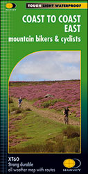
The eastern half of the Coast to Coast Cycle Route between Kirkby Stephen and Robin Hood`s Bay on a double-sided, light, waterproof and tear-resistant, GPS compatible map at 1:60,000 from Harvey Map Services. This version is specially designed for cyclists and mountain bikers.The map shows that stretch of the route in just two panels. Coverage starts west of Kirkby Stephen to provide a convenient overlap with the publishers’ map covering the western part of the route. The map highlights both the northern (St Bees to Robin Hood’s Bay) and the southern (Ravenglass to Ravenscar) alternatives. The route is shown on mapping with contours at 75m intervals. Colouring indicates altitude and land cover: farmland, moorland, etc. The overprint highlighting the route shows whether it is on track, path, undefined path or road. The map also shows other local right of way paths. A wide range of symbols shows various facilities and tourist attractions, including campsites, youth hostels and other accommodation options, food shops and pubs, banks, etc. Each panel has the lines of the British National Grid. Accompanying text provides contact details for tourist information and other useful advice.PLEASE NOTE: this one is the publishers’ two cycling maps of the Coast to Coast route. Harveys also publish two hiking maps of this trail at 1:40,000 – both are listed on our website in the ‘Great Britain: Harvey Maps of Long-distance Hiking Trails” series.

Related Products:
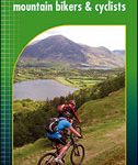 Coast to Coast West Mountain Bikers & Cyclists: St Bees to Kirkby Stephen
 Coast to Coast – St Bees to Robin Hood’s Bay Harvey XT40 National Trail Map
 Coast to Coast Walk Part 2 East – Swaledale to Robin Hood`s Bay
 The Coast to Coast Walk: St Bees to Robin Hood`s Bay
 Wainwright`s Coast to Coast Walk: From St Bees Head to Robin Hood`s Bay
 Coast to Coast: St Bees to Robin Hood`s Bay
 Coast to Coast Path (Trailblazer British Walking Guide): 109 Large-Scale Walking Maps & Guides to 33 Towns & Villages – Planning, Places to Stay, Places to Eat – St Bees to Robin Hood`s Bay
 Kirkby Stephen: Solid and Drift Geology Map
 Askrigg – Kirkby Stephen & Upper Swaledale 1904 – 40
 Kirkby Stephen 1911 – 23.15
 The Adventures of Robin Hood
 The Adventures of Robin Hood: Green Puffin Classics
 Robin Hood
 Appleby-in-Westmorland – Brough & Kirkby Stephen OS Landranger 91
 Appleby-in-Westmorland – Brough & Kirkby Stephen OS Landranger 91 ACTIVE
 Whitby, Robin Hood`s Bay & Staithes Historic Walking Guides
 East Highland Way Harvey National Trail XT40
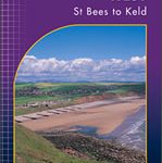 Coast to Coast West – St Bees to Keld Harvey National Trail XT40
 Whitby & Esk Dale – Robin Hood’s Bay OS Landranger 94
 Robin Hood Yard
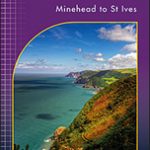 South West Coast Path 1 – Minehead to St Ives Harvey National Trail XT40
 Pembrokeshire Coast Path Harvey National Trail XT40
 Whitby, Esk Dale & Robin Hood’s Bay OS Landranger Active Map 94 (waterproof)
 South West Coast Path 3 – Plymouth to Poole Harbour Harvey National Trail XT40
 Coast to Coast Walk Part 1 – St. Bees to Swaledale
 Northumberland Coast Path & Berwickshire Coastal Path Harvey National Trail XT40
 South West Coast Path 2 – St Ives to Plymouth Harvey National Trail XT40
 Yorkshire Coast Path: A guide to walking 120 miles of magnificent coastline from Redcar to the Humber
 North Downs Way Harvey National Trail XT40
 Mt. Hood Area Trail Map
 Cornwall Coast Path – Bude to Plymouth (South West Coast Path Part 2)
 Pennine Way South Harvey XT40 National Trail Map
 St Oswald`s Way Harvey National Trail XT40
 Robin of Sherwood
 Dorset and South Devon Coast Path – Plymouth to Poole (South West Coast Path Part 3)
 Settle to Carlisle Way Harvey National Trail XT40
 Robin Robin: The Official Book of the Film
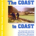 Coast to Coast
 The Robin: A Biography
 North Coast Journey Nicolson Road Map