Disclosure : This site contains affiliate links to products. We may receive a commission for purchases made through these links.
Clermont-Ferrand IGN Street Map

Street plan of Clermont-Ferrand at 1:12,500 from the Institut Gรฉographique National, the country’s national survey organization, with an enlargement showing the town centre in greater detail.`IGN street plans include outer suburbs and, where appropriate, adjoining localities forming part of the urban agglomeration. The plans prominently highlight principal traffic arteries and show one way streets, car parks and pedestrian zones. Latest editions also indicate 24h petrol stations and streets with separate cycle paths. Many streets are annotated with selected house for easier identification of addresses. Important public buildings are named and symbols mark locations of tourist information centres and other facilities. Street index, arranged by an administrative area, is next to the map. Map legend includes English.PLEASE NOTE: to see the list of IGN street plans of French towns and cities please click on the series link ‘“ the series description also includes a comparison between IGN and Blay-Foldex street plans.

Related Products:
 Avignon IGN Street Map
 Nice IGN Street Map
 Clermont-Ferrand Blay-Foldex Street Plan
 Reims IGN Street Map
 Marseille IGN Street Map
 France: IGN Street Plans
 Cannes – Antibes IGN Street Map
 Bolton – Bury A-Z Street Atlas
 Manchester A-Z Big Street Atlas SPIRAL-BOUND
 Helsinki Region Street Atlas
 Aberdeen A-Z Street Atlas
 Isle of Wight A-Z Street Atlas
 Bristol – Bath A-Z Street Atlas
 Dartford – Gravesend A-Z Street Atlas
 Bournemouth – Poole – Christchurch A-Z Street Atlas
 Hastings – Bexhill – St. Leonards – Rye A-Z Street Atlas
 Weymouth – Dorchester A-Z Street Atlas
 Southport – Formby – Ormskirk – Skelmersdale A-Z Street Atlas
 Blackburn – Accrington – Burnley A-Z Street Atlas
 Macclesfield – Congleton – Knutsford – Wilmslow A-Z Street Atlas
 Wirral – Birkenhead – Ellesmere Port – Wallasey A-Z Street Atlas
 Basingstoke- Andover – Overton – Whitchurch A-Z Street Atlas
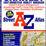 Crawley – East Grinstead – Horley – Horsham A-Z Street Atlas
 Weston-super-Mare – Burnham-on-Sea – Clevedon A-Z Street Atlas
 Chichester – Bognor – Littlehampton – Arundel A-Z Street Atlas
 Loughborough – Melton Mowbray A-Z Street Atlas
 Kingston upon Hull – Barton-upon-Humber – Beverley A-Z Street Atlas
 Bath – Bradford-on-Avon – Trowbridge A-Z Street Atlas
 Bangor – Conwy – Rhyl – Colwyn Bay – Llandudno A-Z Street Atlas
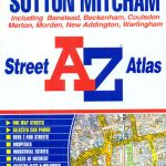 Croydon – Purley – Sutton – Mitcham A-Z Street Atlas
 Burton upon Trent – Ashby-de-la-Zouch – Coalville – Swadlincote A-Z Street Atlas
 Middlesbrough – Stockton-on-Tees A-Z Street Atlas
 Paris IGN WATERPROOF Street Map
 Glasgow – Hamilton – Motherwell – Paisley A-Z Street Atlas
 Barcelona: Greater Barcenona Telstar Street Atlas
 Maidstone & Medway Towns A-Z Street Atlas
 Huddersfield – Batley – Cleckheaton – Dewsbury – Mirfield A-Z Street Atlas
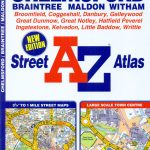 Chelmsford – Braintree – Maldon – Witham A-Z Street Atlas
 Mansfield – Kirkby-in-Ashfield – Sutton-in-Ashfield A-Z Street Atlas
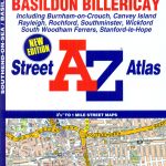 Southend-on-Sea – Basildon – Billericay A-Z Street Atlas