Disclosure : This site contains affiliate links to products. We may receive a commission for purchases made through these links.
Clapham Park & Balham 1894 – 125.2
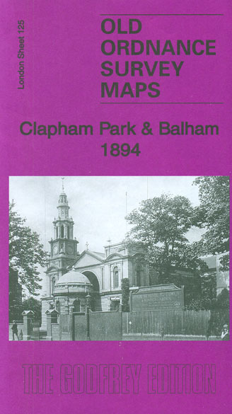
Clapham Park and Balham in 1894 in a fascinating series of reproductions of old Ordnance Survey plans in the Alan Godfrey Editions, ideal for anyone interested in the history of their neighbourhood or family. Three versions have been published for this area, stretching from Mayford Road and Wontner Road eastward to Montrell Road and Killieser Avenue, and from Temperley Road and Yukon Road southward to Ritherdon Road and Mount Ephraim Road. These streets, however, are generally not yet built on the 1872 map, where development is at an earlier stage; this map is very attractive, showing villas on the main roads with their leafy gardens. Principal roads on all the maps are a long stretch of Balham Road on the west side of the map, and Atkins Road, Thornton Road and New Park Road in the Clapham Park area to the east. Other features include Balham and Streatham Hill stations, Bedfordhill House, Tooting Bec Common. Each map has street directory extracts and the 1872 map has the Balham Court Guide. About the Alan Godfrey Editions of the 25″ OS SeriesSelected towns in Great Britain and Ireland are covered by maps showing the extent of urban development in the last decades of the 19th and early 20th century. The plans have been taken from the Ordnance Survey mapping and reprinted at about 15 inches to one mile (1:4,340). On the reverse most maps have historical notes and many also include extracts from contemporary directories. Most maps cover about one mile (1.6kms) north/south, one and a half miles (2.4kms) across; adjoining sheets can be combined to provide wider coverage.FOR MORE INFORMATION AND A COMPLETE LIST OF ALL AVAILABLE TITLES PLEASE CLICK ON THE SERIES LINK.

Related Products:
 Clapham Park & Balham 1913 – 125.3
 Battersea & Clapham 1894 – 101.2
Clapham Common 1894 – 115.2
Battersea & Clapham 1894 – 101.2
Clapham Common 1894 – 115.2
 Battersea & Clapham 1870 – 101.1
 Battersea & Clapham 1913 – 101.3
 Clapham Common 1870 – 115.1
 Clapham Common 1914 – 115.3
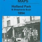 Holland Park & Shepherds Bush 1894 – 73.2
 Alexandra Park & South Friern 1894 – 6a
Kensal Green & Queen`s Park 1894 – 47.2
Alexandra Park & South Friern 1894 – 6a
Kensal Green & Queen`s Park 1894 – 47.2
 Euston & Regent`s Park 1894 – 49.2
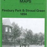 Finsbury Park and Stroud Green 1894
Blackheath & Greenwich Park 1894 – 105.2
Finsbury Park and Stroud Green 1894
Blackheath & Greenwich Park 1894 – 105.2
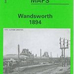 Wandsworth 1894 – 114a
 Trafford Park South 1937
 Croydon East: Coombe Park & Addiscombe Road 1895 – 158
Hornsey 1894 – 12.2
Croydon East: Coombe Park & Addiscombe Road 1895 – 158
Hornsey 1894 – 12.2
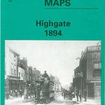 Highgate 1894 – 19.2
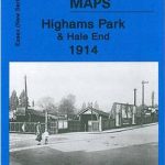 Highams Park and Hale End 1915 – 78.01
Stoke Newington 1894 – 30.2
Highams Park and Hale End 1915 – 78.01
Stoke Newington 1894 – 30.2
 Streatham Hill & Tulse Hill 1894 – 126.2
 Wood Green 1894 – 7.2
Willesden and Stonebridge Park 1936
Wood Green 1894 – 7.2
Willesden and Stonebridge Park 1936
 Upper Edmonton 1894 – 3a
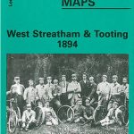 West Streatham & Tooting 1894 – 135a
 Beckenham South 1894
 Tottenham (North) 1894 – 8a
 Ilford 1894
North Finchley 1894
Ilford 1894
North Finchley 1894
 Putney & NW Wandsworth 1894 – 113.2
Central Newcastle 1894 – 11a
Putney & NW Wandsworth 1894 – 113.2
Central Newcastle 1894 – 11a
 Upper Sydenham 1894 – 137.2
 East Finchley 1894 – 10.2
West Twickenham & Strawberry Hill 1894 – 121a
Durham City East 1894
East Finchley 1894 – 10.2
West Twickenham & Strawberry Hill 1894 – 121a
Durham City East 1894
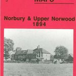 Norbury and Upper Norwood 1894
 Greenford 1894
 Kensington 1894 – 74.2
Teddington & Hampton Hill 1894 – 131.2
Kensington 1894 – 74.2
Teddington & Hampton Hill 1894 – 131.2
 Holland Park & Shepherds Bush 1871 – 73.1