Disclosure : This site contains affiliate links to products. We may receive a commission for purchases made through these links.
City of Salisbury with West Harnham & East Harnham 1900 – 66.15
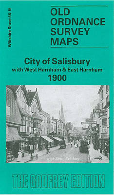
Salisbury City with West and East Harnham in 1900 in a fascinating series of reproductions of old Ordnance Survey plans in the Alan Godfrey Editions, ideal for anyone interested in the history of their neighbourhood or family. The map covers the southern part of Salisbury extending from Milford Street southward to East Harnham and Salisbury Workhouse, and from West Harnham eastward to Fowler`s Hill. Features include Cathedral and The Close, St Nicholas Hospital, General Infirmary, Leyden Hall, Choristers School, Bishop`s Palace, St Martin`s church, clock factory, New Canal area, River Avon, Old Mill, West Harnham with St George`s church, Parsonage Farm, East Harnham with All Saints church, Harnham House, Salisbury Union Workhouse, Harnham Bridge. On the reverse are street directory entries for The Canal, Catherine Street, Exeter Street, The Friary, Milford Hill, Milford Street. About the Alan Godfrey Editions of the 25″ OS SeriesSelected towns in Great Britain and Ireland are covered by maps showing the extent of urban development in the last decades of the 19th and early 20th century. The plans have been taken from the Ordnance Survey mapping and reprinted at about 15 inches to one mile (1:4,340). On the reverse most maps have historical notes and many also include extracts from contemporary directories. Most maps cover about one mile (1.6kms) north/south, one and a half miles (2.4kms) across; adjoining sheets can be combined to provide wider coverage.FOR MORE INFORMATION AND A COMPLETE LIST OF ALL AVAILABLE TITLES PLEASE CLICK ON THE SERIES LINK.

Related Products:
 Shrewsbury West 1900
 Sedgley South-East with Swan Village and West Coseley 1901
 Worcester South-East 1902
Shaftesbury 1900
Sturminster Newton 1900
Worcester South-East 1902
Shaftesbury 1900
Sturminster Newton 1900
 Sheffield (West) 1903 – 294.07b
Wisbech 1900
Maldon West 1920 – 55.16
East Jarrow 1913
Wimborne Minster 1900
March Station 1900
Sheffield (West) 1903 – 294.07b
Wisbech 1900
Maldon West 1920 – 55.16
East Jarrow 1913
Wimborne Minster 1900
March Station 1900
 Newquay West 1933
Ipswich South-West 1902
Swindon South-East 1899
Tamworth 1900
Swindon South-West 1899
Tettenhall 1900
West Bromwich 1902 – 68.10b
Bangor East 1901
Bow, Bromley & West Ham 1867 – 53.1
Swanage 1900
Redditch East 1903
Inverness West 1903
Newquay West 1933
Ipswich South-West 1902
Swindon South-East 1899
Tamworth 1900
Swindon South-West 1899
Tettenhall 1900
West Bromwich 1902 – 68.10b
Bangor East 1901
Bow, Bromley & West Ham 1867 – 53.1
Swanage 1900
Redditch East 1903
Inverness West 1903
 Chelsea & West Brompton 1894 – 87.2
Worcester North-East 1902
Chelsea & West Brompton 1894 – 87.2
Worcester North-East 1902
 Sale South-West 1908
Bridport 1901
Halifax South West and Sowerby Bridge 1892
Craigendoran and Helensburgh East 1897
Sale South-West 1908
Bridport 1901
Halifax South West and Sowerby Bridge 1892
Craigendoran and Helensburgh East 1897
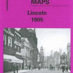 City of Lincoln 1905 – 70.07a
East Barnet & Southgate 1897 – 7.09
Poole 1900
Great Malvern and West Malvern 1926
Maldon (East) 1920 – 56.13
Houghton le Spring 1895
Wrexham West 1909
Manchester South-East 1915
City of Lincoln 1905 – 70.07a
East Barnet & Southgate 1897 – 7.09
Poole 1900
Great Malvern and West Malvern 1926
Maldon (East) 1920 – 56.13
Houghton le Spring 1895
Wrexham West 1909
Manchester South-East 1915
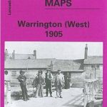 Warrington West 1905
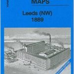 Leeds North West 1889 (Colour Edition)
Barnsley North East 1904
Leeds North West 1889 (Colour Edition)
Barnsley North East 1904