Disclosure : This site contains affiliate links to products. We may receive a commission for purchases made through these links.
Cirencester and Northleach 1898
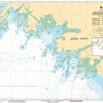
Cirencester and Northleach in 1898 in a series of reproductions of Ordnance Survey’s famous “Inch to the Mile” maps published in the Alan Godfrey Editions to provide a historical record of England and Wales in the second half of 19th and early 20th century.The map covers the area of east Gloucestershire around and to the north of Cirencester, stretching northward from Fairford to Dowdeswell, and from Elkstone eastward to Little Faringdon. Other locations on the map include: in GLOUCESTERSHIRE Aldsworth, Ampney Crucis, Ampney St Mary, Ampney St Peter, Aston Blank, Bagendon, Barnsley, Baunton, Bibury, Chedworth, Clapton, Cobenley, Colesborne, Coln Rogers, Coln St Aldwyn, Coln St Dennis, Compton Abdale, Cowley, Daglingworth, Duntisborne Abbotts, Duntisbotrne Rouse, Eastington, Eastleach Martin, Eastleach Turville, Farmington, Great Barrington, Great Rissington, Hampnett, Hatherop, Hazleton, Little Barrington, Little Rissington, North Cerney, Poulton, Preston, Quenington, Rendcomb, Sherborne, Shipton, Southrop, Stowell, Stratton, Taynton, Turkdean, Windrush, Winson, Winstone, Withington and Yanworth; plus in OXFORDSHIRE Broughton Poggs, Fifield, Holwell and Westwell. On the reverse is a detailed map of Northleach.About the Alan Godfrey Editions of the OS Inch to the Mile Maps: the maps provide an invaluable overview of a wider area, typically 18 x 12 miles (29 x 19 kms approx.), and offer historical mapping for small towns and villages not covered by the more detailed series for which the Godfrey Editions are better known. On the reverse all the maps have historical notes and most titles also include a more detailed, large scale map of a small town or a village in the area.To see other titles in this series please click on the series link.

Related Products:
 Cirencester East 1920
Holy Island & Seahouses 1898 – 4.1 Coloured Edition
Andover, Whitchurch and the Hampshire Downs 1898
Hertford and St Albans 1898
Macclesfield, Congleton and District 1898
North West Gloucestershire 1896
Swindon, Highworth and District 1893
North Herefordshire 1898
Cirencester East 1920
Holy Island & Seahouses 1898 – 4.1 Coloured Edition
Andover, Whitchurch and the Hampshire Downs 1898
Hertford and St Albans 1898
Macclesfield, Congleton and District 1898
North West Gloucestershire 1896
Swindon, Highworth and District 1893
North Herefordshire 1898
 Wallasey Village 1898
Oban 1898 – 98.07
Dudley, Bridgnorth and District 1898
Eyemouth 1898 – 6.13
Alston 1898
Duns & Greenlaw 1898 – 16.07
Wallasey Village 1898
Oban 1898 – 98.07
Dudley, Bridgnorth and District 1898
Eyemouth 1898 – 6.13
Alston 1898
Duns & Greenlaw 1898 – 16.07
 Darlington (South) 1898 – 55.10a
Annan 1898
Newbury 1898 – 43.01
Darlington (South) 1898 – 55.10a
Annan 1898
Newbury 1898 – 43.01
 Kidsgrove 1898
Keswick 1898
Bidston 1898
Fairford 1920 – 52.12
Kidsgrove 1898
Keswick 1898
Bidston 1898
Fairford 1920 – 52.12
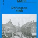 Darlington 1898 – 55.06a
Cockermouth 1898
Darlington 1898 – 55.06a
Cockermouth 1898
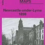 Newcastle-under-Lyme 1898 – 17.04b
Campbeltown 1898 – 257.08
Newcastle-under-Lyme 1898 – 17.04b
Campbeltown 1898 – 257.08
 Barry 1898 – 50.04a
Darlington West 1898
Barry 1898 – 50.04a
Darlington West 1898
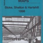 Stoke, Shelton & Hartshill 1898 – 18.01
Melton Mowbray & District 1898 – 142.1 Coloured Edition
Stoke, Shelton & Hartshill 1898 – 18.01
Melton Mowbray & District 1898 – 142.1 Coloured Edition
 Mill Hill Village 1898
 Stoke upon Trent (South) 1898 – 18.05
Friern Barnet and New Southgate 1898
Stoke upon Trent (South) 1898 – 18.05
Friern Barnet and New Southgate 1898
 Falkirk 1898
 Great Britain: Godfrey Editions of Historical Ordnance Survey Inch to a Mile Maps of England & Wales
Nenthead 1898
Great Britain: Godfrey Editions of Historical Ordnance Survey Inch to a Mile Maps of England & Wales
Nenthead 1898
 The Cotswolds – Burford, Chipping Campden, Cirencester & Stow-on-the-Wold OS Explorer Map OL45 (paper)
North Kent Coast 1878
The Cotswolds – Burford, Chipping Campden, Cirencester & Stow-on-the-Wold OS Explorer Map OL45 (paper)
North Kent Coast 1878
 The Cotswolds – Burford, Chipping Campden, Cirencester & Stow-on-the-Wold OS Explorer Active Map OL45 (waterproof)
North Tynedale 1902 – 13
North Chilterns 1888
The Cotswolds – Burford, Chipping Campden, Cirencester & Stow-on-the-Wold OS Explorer Active Map OL45 (waterproof)
North Tynedale 1902 – 13
North Chilterns 1888