Disclosure : This site contains affiliate links to products. We may receive a commission for purchases made through these links.
Church Stretton and Wenlock Edge 1906
Church Stretton and Wenlock Edge in 1906 in a series of reproductions of Ordnance Survey’s famous “Inch to the Mile” maps published in the Alan Godfrey Editions to provide a historical record of England and Wales in the second half of 19th and early 20th century.In this title coverage stretches from Ratlinghope and the Longmynd eastward to Morville Hall, Aston Eyre and Upton Cressett; and from All Stretton southward to Clungunford and Onibury. A long stretch of Wenlock Edge runs diagonally across much of the map, with Brown Clee Hill and Caer Caradoc Hill other much loved landmarks. Other locations covered by the map include Abdon, Acton Scott, All Stretton, Aston Botterell, Burwarton, Cardington, Chetton, Church Stretton, Clee St Margaret, Cleobury North, Cold Weston, Craven Arms, Culmington, Diddlebury, Ditton Priors, Easthope, Farlow, Halford, Heath, Holdgate, Hope Bowdler, Hopesay, Hopton Cangeford, Little Stretton, Loughton, Monkhopton, Munslow, Myndtown, Neenton, Rushbury, Sibdon Carwood, Silvington, Stanton Lacy, Stanton Long, Stoke St Milborough, Stokesay, Tugford, Wentnor and Wheathill. On the reverse is a detailed map of Wistanstow.About the Alan Godfrey Editions of the OS Inch to the Mile Maps: the maps provide an invaluable overview of a wider area, typically 18 x 12 miles (29 x 19 kms approx.), and offer historical mapping for small towns and villages not covered by the more detailed series for which the Godfrey Editions are better known. On the reverse all the maps have historical notes and most titles also include a more detailed, large scale map of a small town or a village in the area.To see other titles in this series please click on the series link.

Related Products:
 The Long Mynd & Wenlock Edge – Church Stretton & Craven Arms OS Explorer 217
 The Long Mynd & Wenlock Edge – Church Stretton & Craven Arms OS Explorer 217 ACTIVE
 Church Stretton, Ludlow & Wenlock Edge OS Landranger Map 137 (paper)
 Church Stretton, Ludlow & Wenlock Edge OS Landranger Active Map 137 (waterproof)
 Ludlow / Llwydlo & Church Stretton 1920-1921
Ludlow / Llwydlo & Church Stretton 1901-1903 – 137
Ludlow / Llwydlo & Church Stretton 1832-1836 – 137
Ludlow / Llwydlo & Church Stretton 1920-1921
Ludlow / Llwydlo & Church Stretton 1901-1903 – 137
Ludlow / Llwydlo & Church Stretton 1832-1836 – 137
 Oswaldtwistle and Church 1909
 Rainhill 1906
 Liverpool Edge Hill 1905
Nether Edge 1903
Liverpool Edge Hill 1905
Nether Edge 1903
 Walking the Shropshire Way: A two-week circular trail including the Wrekin, Stiperstones and Wenlock Edge
 Meanwood and Far Headingley 1906
Hindley Green 1906
Meanwood and Far Headingley 1906
Hindley Green 1906
 Canterbury 1906 – 46.03
Newton-le-Willows 1906
Canterbury 1906 – 46.03
Newton-le-Willows 1906
 St Ives 1906
Montgomery and District 1908
St Ives 1906
Montgomery and District 1908
 Knotty Ash and Old Swan 1906
Hurst and North Ashton 1906
Wadebridge 1906
Bodmin 1906
Redruth 1906
Knotty Ash and Old Swan 1906
Hurst and North Ashton 1906
Wadebridge 1906
Bodmin 1906
Redruth 1906
 Walton on the Hill 1906
The Cheviot 1901-13 – 5
Isle of Thanet 1893 – 274
Penryn 1906
Redesdale 1866
Norham & Berwick 1864 – 1
Helston 1906
Walton on the Hill 1906
The Cheviot 1901-13 – 5
Isle of Thanet 1893 – 274
Penryn 1906
Redesdale 1866
Norham & Berwick 1864 – 1
Helston 1906
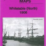 Whitstable (North) 1906 – 23.10
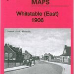 Whitstable East 1906
Ludlow, Tembury and Dirtrict 1897
Whitstable East 1906
Ludlow, Tembury and Dirtrict 1897
 Leeds South and South East 1906
Garstang and District 1896
Kielder 1866
Leeds South and South East 1906
Garstang and District 1896
Kielder 1866
 Central Liverpool 1906 – 106.14b
 Kirkdale 1906
Birmingham North 1913
Kirkdale 1906
Birmingham North 1913
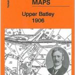 Upper Batley 1906