Disclosure : This site contains affiliate links to products. We may receive a commission for purchases made through these links.
CHS Chart 5065 – Gray Strait and Button Islands
The official Canadian charts provide an excellent range of scales for the whole length of Canada`s coastline as well as the Grat Lakes and comply with Safety of Life at Sea (SOLAS) regulations. PLEASE NOTE: Canadian Hydrographic Service charts are ordered on demand, please allow 1-2 weeks for the order to arrive at Stanfords.
Related Products:
 CHS Chart 8046 – Button Islands to Cod Island
 CHS Chart 8049 – St Michael Bay to Gray Islands
 CHS Chart 5027 – Murphy Head to Button Islands
 CHS Chart 7067 – Spicer Islands to West Entrance of Fury and Hecla Strait
 CHS Chart 7935 – Crozier Strait and Pullen Strait
 CHS Chart 7779 – Dease Strait
 CHS Chart 4023 – Northumberland Strait
 CHS Chart 3902 – Hecate Strait
 CHS Chart 5450 – Hudson Strait
 CHS Chart 5064 – McLelan Strait
 CHS Chart 7784 – Victoria Strait
 CHS Chart 4302 – Strait of Canso
 CHS Chart 3546 – Broughton Strait
 CHS Chart 3462 – Juan de Fuca Strait to Strait of Georgia
 CHS Chart 4653 – Bay of Islands
 CHS Chart 6368 – Cabin Islands to Pilot Islands
 CHS Chart 5002 – Hudson Strait and Bay
 CHS Chart 7552 – Bellot Strait and Approaches
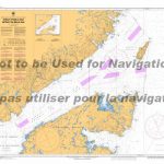 CHS Chart 4020 – Strait of Belle Isle
 CHS Chart 4022 – Cabot Strait and Approaches
 CHS Chart 3606 – Juan de Fuca Strait
 CHS Chart 7487 – Fury and Hecla Strait
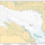 CHS Chart 7776 – Dolphin and Union Strait
 CHS Chart 4335 – Strait of Canso and Approaches
 CHS Chart 3564 – Plans in the Johnstone Strait
 CHS Chart 3535 – Plans in the Malaspina Strait
 CHS Chart 3625 – Scott Islands
 CHS Chart 7010 – Davis Strait and Baffin Bay
 CHS Chart 3602 – Approaches to Juan de Fuca Strait
 CHS Chart 7302 – Lady Ann Strait to Smith Sound
 CHS Chart 7569 – Barrow Strait and Wellington Channel
 CHS Chart 7930 – Hell Gate and Cardigan Strait
 CHS Chart 4301 – Canso Harbour to Strait of Canso
 CHS Chart 5044 – Cape Harrison to Dog Islands
 CHS Chart 5045 – Dog Islands to Cape Makkovik
 CHS Chart 5052 – Seniartlit Islands to Nain
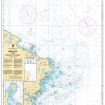 CHS Chart 4857 – Indian Bay to Wadham Islands
 CHS Chart 4825 – Burgeo and Ramea Islands
 CHS Chart 3477 – Plans in the Gulf Islands
 CHS Chart 3536 – Plans in the Strait of Georgia


