Disclosure : This site contains affiliate links to products. We may receive a commission for purchases made through these links.
Chitwan National Park
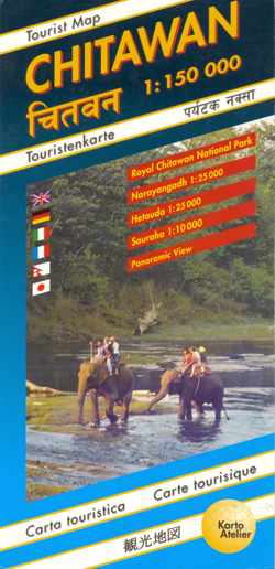
Detailed map of Nepal’s Royal Chitwan National Park, indicating various resorts, lodges and locations where different animals can be found, with enlargements for Narayangadh, Hetauda and Sauraha. The main map at 1:150,000 has contours, relief shading and spot heights, with colouring and graphics indicating different types of terrain and vegetation. Road network shows access from Narayangadh to the park and other settlements. Drawings of local animals mark locations within the park where they are most likely to be seen. Other symbols highlight Tharu villages, crocodile and elephant breeding centres, tourist accommodation and various facilities including bicycle and motorcycle hire, fuel supplies, taxi and bus stands, etc. The map has a latitude and longitude grid at 5’. Map legend includes English.Enlargements at 1:25,000 show Narayangadh and Hetauba areas in greater detail and a plan at 1:10,000 of the parks main centre, Sauraha, indicates various accommodation facilities, restaurants, etc. Also included is a panorama drawing showing the peaks of central Nepal as seen from the parks, from Dhaulagiri in the west, across the various summits of Annapurna to Ganesh and Langtang.

Related Products:
 Stelvio National Park Walking Guide – Italy`s Largest Alpine National Park
 Timanfaya National Park – Lanzarote CNIG Map-Guide ENGLISH
 Paklenica National Park
 Garajonay National Park – Gomera CNIG Map-Guide ENGLISH
 Richtersveld National Park and Northern Namaqualand
 Timanfaya National Park – Lanzarote CNIG Map-Guide SPANISH
 Picos de Europa National Park 2-Map Set Editorial Alpina
 Torres del Paine: Chile`s Premier National Park and Argentina`s Los Glaciares National Park
 Serengeti National Park
 Banff National Park Gem Trek
 Eifel National Park – Ahrtal K+F Outdoor Map 19
 Garajonay National Park – Gomera CNIG Map-Guide SPANISH
 Elbsandsteingebirge ‘“ Sรคchsische Schweiz National Park K+F Map 18
 Kruger National Park
 Skadar Lake National Park
 Kecskemรฉt (with Kiskunsรกg National Park)
 Tara National Park
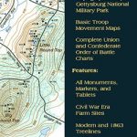 Gettysburg National Miltary Park
 Aukstaitija National Park
 Biebrza National Park ENGLISH
 Lemmenjoki National Park
 Auyuittuq National Park, Nunavut
 Los Glaciares National Park
 Teide National Park – Tenerife CNIG Map-Set
 Khumbu – Sagarmatha National Park
 Saguaro National Park AZ
 Big Bend National Park TX
 Zion National Park UT
 Yosemite National Park CA
 Redwood National Park CA
 Arches National Park UT
 Acadia National Park ME
 Shenandoah National Park VA
 Glacier Bay National Park AK
 Olympic National Park WA
 Haleakala National Park HI
 Badlands National Park SD
 Everglades National Park FL
 Voyageurs National Park MN
 Picos de Europa National Park 3-Map and Guide Set CNIG ENGLISH