Disclosure : This site contains affiliate links to products. We may receive a commission for purchases made through these links.
Chipping Ongar 1915
Chipping Ongar in 1915 in a fascinating series of reproductions of old Ordnance Survey plans in the Alan Godfrey Editions, ideal for anyone interested in the history of their neighbourhood or family. Coverage stretches from the station southward to Marden Ash. Features include the High Street, Sammes Cottages, and the castle site. Coverage continues westward to Greensted, with Greensted Hall and St Andrew`s church, sometimes claimed as the oldest wooden building in Europe. On the reverse are directories for Chipping Ongar, High Ongar and Greensted in 1895.About the Alan Godfrey Editions of the 25″ OS SeriesSelected towns in Great Britain and Ireland are covered by maps showing the extent of urban development in the last decades of the 19th and early 20th century. The plans have been taken from the Ordnance Survey mapping and reprinted at about 15 inches to one mile (1:4,340). On the reverse most maps have historical notes and many also include extracts from contemporary directories. Most maps cover about one mile (1.6kms) north/south, one and a half miles (2.4kms) across; adjoining sheets can be combined to provide wider coverage.FOR MORE INFORMATION AND A COMPLETE LIST OF ALL AVAILABLE TITLES PLEASE CLICK ON THE SERIES LINK.

Related Products:
 Theydon Bois 1915
 Hampstead 1915 – 27.3
East Ham & Barking 1915 – 44.3
Tonypandy & Trealaw 1915 – 27.07
Hampstead 1915 – 27.3
East Ham & Barking 1915 – 44.3
Tonypandy & Trealaw 1915 – 27.07
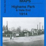 Highams Park and Hale End 1915 – 78.01
Wanstead 1915 – 24.3
Highams Park and Hale End 1915 – 78.01
Wanstead 1915 – 24.3
 Old Trafford 1915
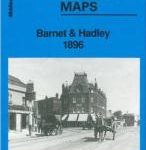 Barnet and Hadley 1896
 Leytonstone & Leyton 1915 – 23.3
 Stanley 1915
Hornchurch 1915 – 79.15
Stanley 1915
Hornchurch 1915 – 79.15
 Cheetham & Higher Broughton 1915 – 104.02b
Pelton Fell 1915
Cheetham & Higher Broughton 1915 – 104.02b
Pelton Fell 1915
 Pendleton North 1915
Brynmawr 1915 – 47.07
Roding Valley and Epping Forest 1886
Manchester South-East 1915
New Quay 1904
Dun Laoghaire 1908
Manchester North West and Central Salford 1915
Newton Heath 1915
Pendleton North 1915
Brynmawr 1915 – 47.07
Roding Valley and Epping Forest 1886
Manchester South-East 1915
New Quay 1904
Dun Laoghaire 1908
Manchester North West and Central Salford 1915
Newton Heath 1915
 Tong 1905
 Reeth and Grinton 1910
Glasgow High Street 1909
Glasgow High Street 1933
Pedmore 1921
Criccieth 1913
Swanage 1900
Reeth and Grinton 1910
Glasgow High Street 1909
Glasgow High Street 1933
Pedmore 1921
Criccieth 1913
Swanage 1900
 Goodmayes and Seven Kings 1915
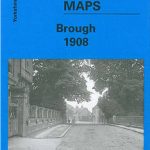 Brough 1908
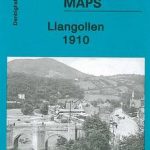 Llangollen 1910
 Plumstead 1867
Bolton upon Dearne 1901
Plumstead 1867
Bolton upon Dearne 1901
 Mid Finchley 1934
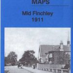 Mid Finchley 1911
Aberaeron 1904
Hopwood Hall and Thornham 1907
Honiton 1903
Denbigh 1910
Crickhowell & Llangattock 1903
Mid Finchley 1911
Aberaeron 1904
Hopwood Hall and Thornham 1907
Honiton 1903
Denbigh 1910
Crickhowell & Llangattock 1903