Disclosure : This site contains affiliate links to products. We may receive a commission for purchases made through these links.
Chile`s Lake District: Pto. Varas – Ensenada – Cochamรณ

The southern part of Chile`s Lake District around Pto. Varas, Ensenada and Cochamรณ on a detailed, double-sided map from Pixmap Cartografรญa Digital providing a vivid presentation of the region’s topography. On one side a map at 1:100,000 covers Lago Llanquihue with Puerto Varas (just north of Puerto Montt) and the area to the east including Volcรกn Osorno, Volcรกn Calbuco, most of Lago Todos los Santos and RalรบnOn the reverse the map continues further south at 1:75,000, extending from the Reloncavi Estuary and Puelo eastwards to El Leรณn. The map base, derived from satellite imagery, has contours at 50m intervals with additional relief shading and spot heights, plus colouring to show glaciers, forest, swamps and grassland. Roads are classified as paved, dirt and 4WD, and local trails are marked.Symbols mark locations of camping areas and campsites, mountain refuges, ranger stations, viewpoints, waterfalls, etc. Latitude and longitude lines are drawn at 5’ intervals, with additional margin ticks for UTM coordinates. Map legend includes English.

Related Products:
 Volcรกn Villarrica – Lago Caburgua
 Torres del Paine – Puerto Natales and Environs
 Lake Llanquihue and Surrounding Region
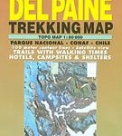 Torres del Paine Trekking Map
 Carretera Austral – Chile
 Oglala National Grassland, Nebraska National Forest and Samuel R. McKelvie National Forest
 Northern Agrafa – Plastira Lake Anavasi 4.1
 Chile NGS Adventure Map 3402
 Lake District Harvey British Mountain Map XT40
 Inylchek – Tien Shan Alpenverein 0/14
 Aconcagua – Cordon del Plata
 Franconia Lake District UK50-22
 Mark Twain National Forest – Houston, Rolla and Cedar Creek Ranger District
 Chile Reise Know-How
 Moletai Lake District
 Borjomi George – Bakuriani Geoland 12
 Ushguli – Lashkheti – Mt.Shkhara Geoland 8
 Oni – Utsera Resort – Ghebi Resort Geoland 7
 Shatili – Mutso – Mt. Didi Borbalo Geoland 2
 WATERPROOF
Shatili – Mutso – Mt. Didi Borbalo Geoland 2
Shatili – Mutso – Mt. Didi Borbalo Geoland 2 WATERPROOF
 Mt Ushba – Mestia Geoland 10 WATERPROOF
 Mt Ushba – Mestia Geoland 10
 Chile and Santiago de Chile
 Mestia – Ushguli – Lashkheti Geoland 9
 WATERPROOF
Tien Shan: Lake Issyk-Kul North Trekking Map
Mestia – Ushguli – Lashkheti Geoland 9
Mestia – Ushguli – Lashkheti Geoland 9 WATERPROOF
Tien Shan: Lake Issyk-Kul North Trekking Map
 Khevi – Mt. Kazbegi – Gudauri – Truso Geoland 4
 Tien Shan: Lake Issyk-Kul North 100K Goskartografiya Trekking Map
 Omalo – Pass Abano – Mt. Diklosmta Geoland 1
 Barisakho – Roshka – Juta – Asa Gorge Geoland 3 WATERPROOF
 Barisakho – Roshka – Juta – Asa Gorge Geoland 3
 Lake District A-Z Visitor`s Atlas & Guide
 Omalo – Pass Abano – Mt. Diklosmta Geoland 1 WATERPROOF
 Khan Tengri – Tien Shan Alpenverein 0/15
 Lake District Outdoor Atlas
 Gosainkunda – Trek to Shiva`s Sacred Lake
 Kaszuby Lake District: Southern Part
 Sanabria Lake and Surroundings NP CNIG Map
 Lake District Mountain Biking – Essential Trails
 Pucon – Villarrrica NP – Huerquehue NP