Disclosure : This site contains affiliate links to products. We may receive a commission for purchases made through these links.
Chicago Borch

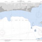
Laminated, waterproof, indexed street plan of downtown Chicago at 1:8,000 from Borch, with small maps of Lincoln Park, Hyde Park, the environs of Chicago, and O’Hare airport. The main map shows one-way streets, with rail, metro, trolley and riverbus lines and stops clearly marked. Points of interest such as museums, theaters, places of worship are shown; the map also includes 30 ‘Top Sights’ that are also indexed.A map of Lincoln Park at 1:16,000 shows a similar level of detail to the main map, as does the small map of Hyde Park on the reverse, at 1:20,000. The reverse also has a map of the environs of Chicago at 1:250,000, showing the major road network, airports, and rail and metro stops. Both of these maps are indexed. A small inset of O’Hare airport shows road access, terminals, and parking lots.A Chicago Transit Authority diagram of the public transport network is provided, as is a small map of US administrative and time zones, as well as a small box detailing climate, population and statistical data on Chicago.

Related Products:
 Chicago & Lake Michigan ITMB
 Boston Borch
 Phoenix Borch
 Athens Borch
 Dublin Borch
 Vienna Borch
 Rio de Janeiro Borch
 Amsterdam Borch
 Madrid Borch
 Prague Borch
 Stockholm Borch
 Singapore Borch
 Beijing Borch
 Montrรฉal Borch
 Barcelona Borch
 Budapest Borch
 San Francisco Borch
 Chicago Regional Rand McNally
 Frankfurt am Main Borch
 Chicago NGS City Destination Map
 Rome Borch
 Brussels Borch
 Philadelphia Borch
 Buenos Aires Borch
 Hamburg Borch
 Vancouver Borch
 Copenhagen Borch
 Munich Borch
 Zurich & Switzerland NW ITMB
 Berlin Borch
 Washington DC Borch
 Sydney Borch
 Bangkok Borch
 St Petersburg Borch
 Hungary & Budapest ITMB
 Chicago Red Maps
 Europe Borch
 Munich & Bavaria ITMB
 Tehran & Northern Iran ITMB