Disclosure : This site contains affiliate links to products. We may receive a commission for purchases made through these links.
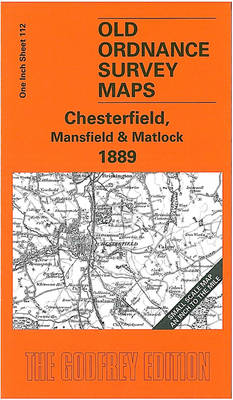
Chesterfield – Mansfield & Matlock 1889 – 112
Related Products:
 Buxton, Matlock, Chesterfield, Bakewell & Dove Dale OS Landranger Map 119 (paper)
 Buxton, Matlock, Chesterfield, Bakewell & Dove Dale OS Landranger Active Map 119 (waterproof)
 Matlock 1898 – 34.03
 Mansfield Woodhouse 1914 – 23.09
 Chesterfield 1898 – 25.06a
 Chesterfield (North) 1897 – 25.02
 Chesterfield: Bedrock & Superficial Deposits
 Knaresborough 1889: Yorkshire Sheet 154.12a
 Cheetham & Higher Broughton 1889 – 104.02a
 City of York 1889 – 174.06a Coloured Edition
 York (South) 1889: Yorkshire Sheet 174.10a
 Mansfield Park
 Mount Mansfield – Stowe VT
 Buxton and Matlock 1921-1923
 Chesterfield 1914 – 25.06b
 Mansfield and Worksop 1902-1903
 Mansfield, Worksop & Sherwood Forest OS Landranger Map 120 (paper)
 Sherwood Forest – Mansfield, Worksop & Edwinstowe OS Explorer Map 270 (paper)
 Mansfield, Worksop & Sherwood Forest OS Landranger Active Map 120 (waterproof)
 Victoria Park 1889
 From Horseshoe to Harper Hill: 750 Mid-grade Sport Climbs in the Buxton and Matlock Area
 Sherwood Forest – Mansfield, Worksop & Edwinstowe OS Explorer Active Map 270 (waterproof)
 South West Berkshire 1889
 Chesterfield & Alfreton – Sutton in Ashfield & Bolsover OS Explorer Map 269 (paper)
 CHS Chart 5630 – Dunne Foxe Island to Chesterfield Inlet
 Huddersfield Central 1889 (Colour Edition)
 Hitler: Volume I: Ascent 1889-1939
 York NE & Heworth 1889 – 174.07 Coloured Edition
 Chesterfield & Alfreton – Sutton in Ashfield & Bolsover OS Explorer Active Map 269 (waterproof)
 CHS Chart 5533 – Roes Welcome Sound (Chesterfield Inlet to Cape Munn)
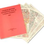 Charles Booth`s Descriptive Map of London Poverty 1889
 Leeds North West 1889 (Colour Edition)
 A Year in Jamaica: Memoirs of a Girl in Arcadia in 1889
 Booth`s Maps of London Poverty: East & West 1889
 A Week on the Broads: Four Victorian Gents at Sail on a Norfolk Gaffer in 1889
 The Peak District – White Peak Area – Buxton – Bakewell – Matlock & Dove Dale OS Expolorer OL24
 The Peak District – White Peak Area – Buxton – Bakewell – Matlock & Dove Dale OS Expolorer OL24 ACTIVE
 Walking in the Peak District – White Peak East: 42 walks in Derbyshire including Bakewell, Matlock and Stoney Middleton
 Mansfield – Kirkby-in-Ashfield – Sutton-in-Ashfield A-Z Street Atlas
 CHS Chart 5620 – Entrance to Chesterfield Inlet (Fairway Island to Ellis Island)


