Disclosure : This site contains affiliate links to products. We may receive a commission for purchases made through these links.
Chelmsford 1919

Chelmsford in 1919 in a fascinating series of reproductions of old Ordnance Survey plans in the Alan Godfrey Editions, ideal for anyone interested in the history of their neighbourhood or family. Chelmsford is covered by two maps. This title covers central Chelmsford and the area eastward to Barnes Lock and Barnes Mill, southward to Whitehouse Farm. Features include Cathedral, station (top left corner), St John`s church, Mesopotamia Island, Cattle Market, Stone Bridge, Shire Hall, Tindal Square, River Chelmer, Moulsham Mill, Chelmer & Blackwater Canal, Holy Trinity church, etc. On the reverse is a list of Private Residents from a 1922 directory.About the Alan Godfrey Editions of the 25″ OS SeriesSelected towns in Great Britain and Ireland are covered by maps showing the extent of urban development in the last decades of the 19th and early 20th century. The plans have been taken from the Ordnance Survey mapping and reprinted at about 15 inches to one mile (1:4,340). On the reverse most maps have historical notes and many also include extracts from contemporary directories. Most maps cover about one mile (1.6kms) north/south, one and a half miles (2.4kms) across; adjoining sheets can be combined to provide wider coverage.FOR MORE INFORMATION AND A COMPLETE LIST OF ALL AVAILABLE TITLES PLEASE CLICK ON THE SERIES LINK.

Related Products:
 Leeds (Harehills, Buslingthorpe & Chapeltown Road) 1919 – 203.14c
 Wickford 1919
Maldon (East) 1920 – 56.13
Wickford 1919
Maldon (East) 1920 – 56.13
 Chelmsford 1919-1922
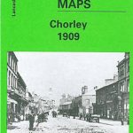 Chorley 1909
 Oswaldtwistle and Church 1909
Horbury 1905
Oswaldtwistle and Church 1909
Horbury 1905
 Godalming 1895
Accrington 1909
Godalming 1895
Accrington 1909
 Liverpool Toxteth Mill Street 1847
 Manchester: Ancoats North 1848
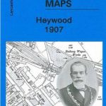 Heywood 1907
 Farnham 1913
Llantwit Major 1914
Horwich North 1907
Blackrod 1907
Padiham 1909
Lampeter 1904
King`s Norton 1903
Farnham 1913
Llantwit Major 1914
Horwich North 1907
Blackrod 1907
Padiham 1909
Lampeter 1904
King`s Norton 1903
 Bollington 1907
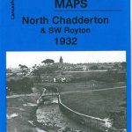 Chadderton North 1932
Westhoughton 1907
Bromsgrove 1926
Ashton-under-Lyne 1916
Boothstown and Astley Green 1904
Sherborne 1901
Chadderton North 1932
Westhoughton 1907
Bromsgrove 1926
Ashton-under-Lyne 1916
Boothstown and Astley Green 1904
Sherborne 1901
 Rochdale West 1908
Campbeltown 1898 – 257.08
Honiton 1903
Rochdale West 1908
Campbeltown 1898 – 257.08
Honiton 1903
 Ewell West 1910
Redditch East 1903
New Quay 1904
Hopwood Hall and Thornham 1907
Bolton South and Great Lever 1927
Ewell West 1910
Redditch East 1903
New Quay 1904
Hopwood Hall and Thornham 1907
Bolton South and Great Lever 1927
 Shortlands 1894
Malvern Link 1926
Shortlands 1894
Malvern Link 1926
 Wickersley 1901
Holmfirth 1904
Wickersley 1901
Holmfirth 1904
 Finchley and Holders Hill 1895
Harborne South 1901
Finchley and Holders Hill 1895
Harborne South 1901