Disclosure : This site contains affiliate links to products. We may receive a commission for purchases made through these links.
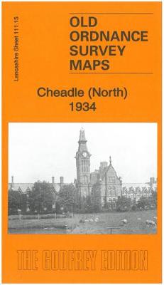
Cheadle (North) 1934 – 111.15b
Related Products:
 Stockport (Edgeley & Cheadle Heath) 1934 – 111.16c
 Cheadle Hulme (North) 1907 – 19.06
 Stockport (North) 1934 – 112.09c
 Cheadle and Cheadle Heath 1897
 Ashford (North) 1934 – 19.16
 Hanworth and North West Hampton 1934
 Denton 1934 – 105.14b
 Hyde 1934 – 112.03c
 Northenden 1934 – 111.14c
 Feltham 1934 – 20.13b
 Ashbourne, Cheadle and District 1895
 Stockport (South) 1934 – 112.13b
 Heaton Chapel 1934 – 111.08c
 Withington, Ladybarn & Burnage 1934 – 111.07c
 Derby – Uttoxeter, Ashbourne & Cheadle OS Explorer Map 259 (paper)
 Derby – Uttoxeter, Ashbourne & Cheadle OS Explorer Active Map 259 (waterproof)
 Mid Finchley 1934
 Ealing 1934
 Carmyle 1934
 Central Glasgow 1934 – 6.10c
 South Ealing 1934 – 70.4
 Glasgow (Bellahouston & Dumbreck) 1934 – 6.13b
 Kempton Park & SW Hampton 1934 – 25.06
 Half-Time: The Glorious Summer of 1934
 Admiralty Chart 1934 – River Tyne
 West Twickenham & Strawberry Hill 1934 – 121b
 Heaton Norris & Heaton Moor 1934 – 111.12c
 SHOM Charts for the North East Atlantic, North Sea, Baltic Sea, Mediterranean Sea
 North-Holland North ANWB Cycling Junction Map 14
 Shetland: Mainland North West – North Roe & Sullom Voe OS Explorer Active Map 469 (waterproof)
 Bavaria North – Baden-Wurttemberg North/East 2-Map Cycling Set Kompass 3710
 Admiralty Chart 4053 – North Pacific Ocean North Western Part
 Shetland: Mainland North West – North Roe & Sullom Voe OS Explorer Map 469 (paper)
 NP252 Tidal Stream Atlas North Sea North-Western Part
 Lower Saxony West – North Rhine-Westphalia North 2-Map Cycling Set Kompass 3704
 Admiralty Chart 164 – North and North-East Approaches to Massawa
 North Norway North: Tromsรธ ‘“ Hammerfest – Kirkenes
 NGA Chart 121 – North Atlantic Ocean, North Sheet
 North Wales – Lon Eifion – Lon Las Cefni – North Wales Coast Route Sustrans Cycle Map 24
 North
North


