Disclosure : This site contains affiliate links to products. We may receive a commission for purchases made through these links.
Ceuta CNIG Topo 1110-3

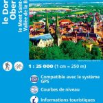
Ceuta, one of the two Spanish territories on the North African coast, on detailed map at 1:25,000 published as part of Spain topographic survey from the Instituto Geogrรกfico Nacional ‘“ Centro Nacional de Informaciรณn Geograficรก, the country’s civilian survey organization. Coverage includes Isla del Perejil.The map has contours at 10m intervals with additional colouring and/or graphics to show different type of land use or vegetation. Full topographic information extends across the Neutral Zone, clearly marked on the map, into the Moroccan side of the border. The map has a 1-km UTM grid, with margin ticks for latitude and longitude at 1` intervals. Map legend is in Spanish only.An inset shows the Straights of Gibraltar and the Mediterranean coastline of Morocco indicating Ceuta, Melilla and the Spanish islands along the coast.

Related Products:
 Ceuta and Melilla CNIG Topo 1110-1111
 Straits of Gibraltar – Costa del Sol – Almerรญa 500K CNIG Regional Map No. 13
 Mahon / Mao CNIG Topo 647
Son Parc CNIG Topo 619
Illa de L`Aire CNIG Topo 673
Sant Joan de Labritja CNIG Topo 773
Mahon / Mao CNIG Topo 647
Son Parc CNIG Topo 619
Illa de L`Aire CNIG Topo 673
Sant Joan de Labritja CNIG Topo 773
 El Castillo CNIG Topo 1094
 Lucena CNIG Topo 989
 Lora del Rio CNIG Topo 963
Martos CNIG Topo 946
Barbastro CNIG Topo 287
Roses CNIG Topo 259
Lora del Rio CNIG Topo 963
Martos CNIG Topo 946
Barbastro CNIG Topo 287
Roses CNIG Topo 259
 Girona CNIG Topo 334
Chinchon CNIG Topo 606
Cercedilla CNIG Topo 508
Lugo CNIG Topo 72
Guntin CNIG Topo 97
Allo CNIG Topo 172
Nerva CNIG Topo 938
Albatera CNIG Topo 892
Bedmar CNIG Topo 948
Olula del Rio CNIG Topo 995
Los Sauces CNIG Topo 1083
Andraitx CNIG Topo 697
Inca CNIG Topo 671
Porreres CNIG Topo 699
Macanor CNIG Topo 700
Alaior CNIG Topo 646
Girona CNIG Topo 334
Chinchon CNIG Topo 606
Cercedilla CNIG Topo 508
Lugo CNIG Topo 72
Guntin CNIG Topo 97
Allo CNIG Topo 172
Nerva CNIG Topo 938
Albatera CNIG Topo 892
Bedmar CNIG Topo 948
Olula del Rio CNIG Topo 995
Los Sauces CNIG Topo 1083
Andraitx CNIG Topo 697
Inca CNIG Topo 671
Porreres CNIG Topo 699
Macanor CNIG Topo 700
Alaior CNIG Topo 646
 Andratx CNIG Topo 697-4
Soller CNIG Topo 670-2
Fiรฑana CNIG Topo 1012
Andratx CNIG Topo 697-4
Soller CNIG Topo 670-2
Fiรฑana CNIG Topo 1012
 Berja CNIG Topo 1043
 Ardales CNIG Topo 1038
Osuna CNIG Topo 1005
Benameji CNIG Topo 1006
Ardales CNIG Topo 1038
Osuna CNIG Topo 1005
Benameji CNIG Topo 1006
 Peรฑaranda de Bracamonte CNIG Topo 479
Formentera CNIG Topo 824/825/849
Alba de Tormes CNIG Topo 504
El Cerro de Andevalo CNIG Topo 937
Canal de San Clemente CNIG Topo 929
Peรฑaranda de Bracamonte CNIG Topo 479
Formentera CNIG Topo 824/825/849
Alba de Tormes CNIG Topo 504
El Cerro de Andevalo CNIG Topo 937
Canal de San Clemente CNIG Topo 929