Disclosure : This site contains affiliate links to products. We may receive a commission for purchases made through these links.
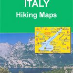
Cervino / Matterhorn – Zermatt – Breuil Cervinia Geo4Map 23

Related Products:
 Matterhorn / Cervino – Breuil Cervinia – Champoluc IGC 108
 Breuil-Cervinia – Zermatt Kompass 87
 Matterhorn / M. Cervino – Monte Rosa IGC 5
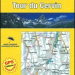 Tour of the Matterhorn / Cervino L`Escursionista Editore Map-Guide
 Zermatt – Matterhorn K+F Hiking 13
 Valtournenche – Monte Cervino / Matterhorn – Val d`Ayas West L`Escursionista Editore 7
 Zermatt – Saas-Fee – Matterhorn – Gornergrat – Mittelallalin Swisstopo Hiking 3306T
 Walkers`s Haute Route: Chamonix to Zermatt: The epic journey between Mont Blanc and the Matterhorn
 Monte Cervino – Valtourneche – Alta Val d’Ayas Fraternali Editore 32
 Cervino – Monte Rosa – Valtourenche – Valle di Champorcher L`Escursionista Editore
 Matterhorn Swisstopo 1347
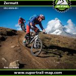 Zermatt Supertrail Map
 Zermatt Freeride Map
 Matterhorn – Mischabel Swisstopo 5006
 Zermatt Swisstopo 1348
 Zermatt – Saas Fee Supertrail Map
 Zermatt – Gornergrat Swisstopo 2515
 Zermatt – Saas Fee – Grachen – Visp – Simplon K+F Hiking Map 24
 Val Grande Geo4Map 14
 Val Vigezzo Geo4Map 5
Grigne Resegone – Valsassina Geo4Map 301
Val Vigezzo Geo4Map 5
Grigne Resegone – Valsassina Geo4Map 301
 Matterhorn
 Val Formazza – Val Bavona – Val Maggia Geo4Map 11 SUPERCEDED
 Valle di Bognanco – NP Alpe Veglia Geo4Map 8
Valle Anzasca – Vanzone – Piedimulera Geo4Map 6
Alto Verbano – Val Grande – Cannobio Geo4Map 15
Lago Maggiore – Luino – Val Veddasca Geo4Map 305
Mischabel – Saas Fee – Grรคchen – Tรคsch Geo4Map 22
Valle di Bognanco – NP Alpe Veglia Geo4Map 8
Valle Anzasca – Vanzone – Piedimulera Geo4Map 6
Alto Verbano – Val Grande – Cannobio Geo4Map 15
Lago Maggiore – Luino – Val Veddasca Geo4Map 305
Mischabel – Saas Fee – Grรคchen – Tรคsch Geo4Map 22
 Matterhorn Tour
 Zermatt
Valle Anzasca – Monte Rosa – Macugnaga Geo4Map 5
Zermatt
Valle Anzasca – Monte Rosa – Macugnaga Geo4Map 5
 Valsesia – Val Mastallone – Boccioleto – Rossa – Varallo Geo4Map 3
 Valle Antrona – Pizzo d`Andolla – Villadossola Geo4Map 7
Cinque Terre – Golfo della Spezia Geo4Map 21
Valle Antrona – Pizzo d`Andolla – Villadossola Geo4Map 7
Cinque Terre – Golfo della Spezia Geo4Map 21
 Valle Cannobina – Val Vigezzo – Monte Limidario Geo4Map 13
Valle del Ticino – Arona – Legnano – Magenta Geo4Map 1
Valle del Ticino – Abbiategrasso – Bereguardo – Pavia Geo4Map 2
Valle Cannobina – Val Vigezzo – Monte Limidario Geo4Map 13
Valle del Ticino – Arona – Legnano – Magenta Geo4Map 1
Valle del Ticino – Abbiategrasso – Bereguardo – Pavia Geo4Map 2
 Matterhorn Cookie Cutter
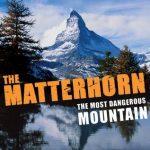 The Matterhorn:The Most Dangerous Mountain
 Matterhorn – Board Game